Uncovering the impact of Taiwan’s drought on critical water resources through satellite data

Uncovering the impact of Taiwan’s drought on critical water resources through satellite data

29 APRIL 2021

Taiwan is usually one of the rainiest places on the planet, however for the past year, little rain has fallen, consequently resulting in the worst drought on the island for the last 56 years. Many water reservoirs throughout the country are falling below 20 % capacity while some are less than 10 % and in danger of drying up.

The detrimental impacts of the water crisis in Taiwan are felt throughout the country and water reduction policies have been implemented in many different sectors and industries to save limited water resources. The water crisis could also have global repercussions by affecting Taiwan’s $100bn semiconductor industry which is responsible for manufacture of up to 90% of worlds advanced microchips.

In a country where water resources have historically been plentiful, the impacts of a changing climate and unsustainable water resources management practices could have dire consequences. The first step towards sustainable water resource management is to ensure proper and timely information on water (non-) availability to inform water management activities.

Through our ESA funded project 'WorldWater', novel approaches to monitor surface water dynamics in both extent and volume, are being developed, to demonstrate the potential of earth observation to underpin cost-effective and robust monitoring of water resources at all scales. Applying these new methods and tools, we uncovered the water dynamics in both extent of volume over the past two years, in Taiwan’s largest reservoir ‘Tsengwen’, which as of April 2021 reportedly is at less than 12 % of its capacity.

Through an integrated approach, using both Sentinel 1 (SAR), 2 (optical) and 3 (altimetry) data, the entire water regime of Tsengwen reservoir can effectively be monitored in high temporal and spatial resolution from space. As can be seen from the illustration below, as of late March 2021, the reservoir is more than 10 m below its median level from 2018-2021, and the low water level is also clearly depicted as the difference between the surface water dynamics between 2019-2020 and 2020-2021.

MOOD Decom – MetOcean On Demand Decommissioning (Feasibility study)

Why is it important?

Decommissioning of offshore energy assets is set to become a huge task in the coming years for both operators of the assets and authorities; a task that comes with a cost of 100’s of billions of euros globally. Considering this, activities offering a cost reduction will have significant impact – and interest – for the decommissioning stakeholders, even more if activities furthermore offer reduced health and safety issues and better control of environmental impacts.

The MOOD Decom Feasibility Study sets out to assess and explore the value of applying satellite earth observation data for providing accurate metocean data with quantified uncertainty for securing safe, compliant, efficient and cost-effective solutions for the decommissioning activities foreseen for European offshore energy assets over the coming years and decades.

Project highlights:

Feasibility study evaluating EO-enriched metocean services for compliant, safe and efficient end-to-end decommissioning operations that are most business critical.

EO-enriched metocean data with quantified uncertainties and probabilistic measures of workability for short and long-term planning of operations.

More efficient and safer operations with associated lower costs for decommissioning stakeholders.

In more detail..

The decommissioning of energy assets entails a chain of complex decisions on environmental impact risks, logistics and worker safety. Operations are strongly affected by several environmental influences such as tides, currents, waves, winds, sea temperature and salinity.

Today’s decision-making is typically based on metocean data analyses, for instance by assessing how often the significant wave height is less than a certain threshold during a given period. Actual decision drivers, such as heavy lift vessel motions, drag on an underwater remotely operated vehicle by currents, scour holes around the legs of jack-up vessels, are not directly addressed. This leads to either unnecessary conservativism or risk underestimation resulting in sub-optimal cost-efficiency.

MOOD Decom will support decommissioning industry and operators in Oil & Gas and Offshore Wind with:

  • High-quality metocean information with quantified uncertainties
  • Integration of metocean data with probabilistic measures of workability
  • Near-real-time metocean parameters for environmental impact monitoring
The activity will establish an easy-to-use online tool, where the assimilation and fusion of EO-data in near-real time will ingest satellite data into a forecast service providing information of metocean conditions near installations at sea and along routes to/from the installations.

Parallel to the operational forecast system, we will establish a database of metocean hindcast-data with historical information of relevant parameters for the long-term planning of operations at sea. These two parallel systems will form the backbone of a new DHI operated decommissioning decision support system, enabling more efficient and safer operations with associated lower costs for decommissioning stakeholders.

European Space Agency:

The European Space Agency (ESA) is the European space programme and its mission is to explore Earth, its immediate space environment, our Solar System and the Universe.

ESA also works closely with space organisations outside Europe to develop satellite-based technologies and services, and to promote European industries. ​

Related items

Global Seas

Delivering earth observation enriched high-quality metocean data to enhance fuel efficiency in the shipping industry. . . .

Read More

EOatDHI part of the DHI GROUP

gras@dhigroup.com
+45 4516 9100

Agern Alle 5,
2970 Hørsholm,
Denmark

CVR: 36466871

NANOK – Nautical Navigation Operational Knowledge

Why is it important?

Maritime operations in the Arctic are often associated with high level of navigational risk since access to reliable nautical charts is limited by the fact that existing charts are often several nautical miles off, with vast areas still uncharted.

Meanwhile, the level of human activity in the Arctic is increasing. Climate changes widens the areas of operation in the Arctic, with ice-free conditions, enabling expansion of economic activities, access to natural resources and opening of new shipping routes. Also, increased research and tourism activities leads to an increase in marine traffic across the Arctic region.

In all, this leads to an enlarged geopolitical awareness of the Arctic region and in turn also an intensified military awareness and presence in the region.

The Danish Defense undertakes several tasks in the Arctic, including enforcement of sovereignty, search and rescue operations, fishing controls as well as societal tasks, e.g., scientific and medical logistical support. In this context NANOK provides the much-needed navigational situational awareness reducing navigational risks in the Arctic region.

Project highlights:

NANOK develops an automation and upscaling feasibility study of navigational hazards including 1) submerged rocks, 2) coast lines and 3) intertidal zones applicable to all arctic regions.

The NANOK data products are tailored to naval navigation systems and user requirements.

NANOK data products are processed in a cloud-computing environment allowing rapid data production and updating.

In more detail..

Maritime activity across the Arctic is increasing together with an increased geopolitical awareness in the region. Maritime operations in the Arctic are associated with high level of navigational risk since access to reliable nautical charts is limited by the fact that existing charts are often several nautical miles off, with vast areas still uncharted.

This situation often leaves navigators with on board equipment such as different types of sonar systems, offering little decision support on route planning and forward-looking situational awareness at a larger scale. The activities in the NANOK project are expected to significantly support route planning and situational awareness for a wide range of both civil and naval tasks.

NANOK is co-financed by and developed in collaboration with the Danish Defence and data products are consequently tailored to specific naval user requirements through dialogue-based co-production and onboard field testing.

The NANOK project develops Arctic navigational risk minimization by mapping submerged rocks, intertidal zones and coast lines. It includes an automation and upscaling feasibility test in Greenland of two previously developed remote sensing processing chains:

  • Mapping of Arctic shallow water areas using a DHI GRAS proprietary multitemporal bathymetric retrieval model based on open-source satellite data, validated against in-situ multi-beam echo sounding data.
  • Mapping of Arctic coastlines using a DHI GRAS proprietary method involving satellite data, intertidal information, machine learning.
The project reaches out to international Arctic stakeholders paving the way for a further product development and pan-arctic navigational risk minimization.

NANOK is co-financed by the Danish Defence Acquisition and Logistics Organization and DHI GRAS and is supported by the Danish Naval Warfare Centre and the Danish Defence Joint GeoMETOC Support Center.

Related items

EOatDHI part of the DHI GROUP

gras@dhigroup.com
+45 4516 9100

Agern Alle 5,
2970 Hørsholm,
Denmark

CVR: 36466871

Satellite-based monitoring of offshore wind farms

Satellite based monitoring of offshore wind farms

21 APRIL 2021

Offshore wind has been growing rapidly in recent years, as an attractive and clean energy alternative. However rigorous environmental legislation and a harsh and dynamic environment require thorough and meticulous planning, as well as continuous operational monitoring of windmill installations and the dynamics of the surrounding water bodies, to ensure safe and reliable operation of offshore wind assets.

The majority of the data and information needed to plan, construct and operate offshore wind farms is costly, time consuming and risky to collect, requiring rigorous field campaigns and expensive equipment.

Satellite-based products and services provide a powerful, low cost and efficient alternative to supplement or replace traditional monitoring solutions, by delivering up-to-date and comprehensive intelligence on the dynamics of the seabed and conditions of the environment around offshore wind installations.

Our satellite based services for offshore wind farms include;

Sandwave movement at Horns Rev 3 offshore wind farm in Denmark

AI4ALERT

Why is it important?

Satellite technology has been through explosive development in recent years and new sensors with augmented capabilities – even entire constellations of microsatellites – are sent into space on a regular basis. As a result, satellite data provides new avenues to underpin time-critical geointelligence solutions. This project will uncover existing needs and requirements for security and defence related geointelligence solutions among stakeholders in Denmark and demonstrate how these can be addressed through novel satellite-based applications.

Project highlights:

Analysing and documenting existing needs and requirements for time-critical geointelligence solutions among key stakeholders in defence and security.

Developing novel geointelligence solutions through the application of deep learning technology and multisource earth observation data.

Demonstrating and testing the potential of satellite-based geointelligence solutions through application in relevant use case scenarios and provision of tailormade webinars to connect industry leaders and relevant stakeholders in the security and defence related sectors.

In more detail..

Satellite technology has been through rapid development in recent years and every day, hundreds of satellites orbit above us in space with one purpose – to acquire and deliver timely data and information about our planet. Combined with new and improved data handling and processing capabilities, cloud computing and machine learning, satellite data provides new avenues to improve and augment geointelligence capacities and solutions.

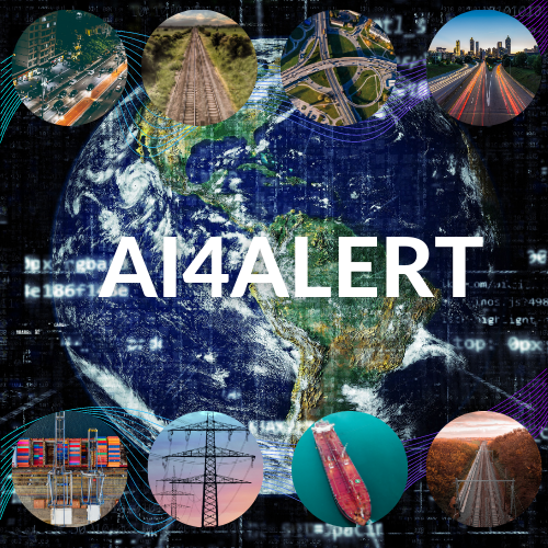
Artificial Intelligence for Acute Living Earth Reconnaissance Technology “AI4ALERT” aims to uncover existing needs for time-critical geointelligence solutions among stakeholders working with critical infrastructure or otherwise operate within a defense and security context.

Through a series of bilateral meetings and online webinars with key stakeholders, the project will seek to connect industry leaders and document existing technology gaps and unmet needs for geointelligence. Consequently, the project will demonstrate how the combination of novel satellite data sources and deep learning technology can power scaleable, autonomous and intelligent solutions to address a variety of these needs.

Examples of such services include:
  • Monitoring critical infrastructure (e.g. detecting fallen trees or other obstacles on roads and railways, monitoring vegetation growth in the vicinity of electrical grids, detecting unapproved excavation work nearby power- and gas lines, monitoring soil moisture to detect waterpipe leaks, mapping flooded roads as well as general dynamic monitoring of traffic movement);
  • Tracking and monitoring activity patterns and movement in operational scenarios (i.e., detecting and monitoring the number of people and cars to provide insight into activity patterns and early warnings for unusual activities);
  • Monitoring the impact of emergency events (e.g. the extent of flooding’s and identification of people and housing impacted, monitoring fire risk and ongoing fire extent and movement, detecting and tracking oil spills, etc.).
Such solutions and information services could underpin a range of core geointelligence needs among a wide range of private and public stakeholders in both Denmark and internationally, including emergency authorities, the police, the defence, national security agencies, airports, ports and harbors, utilities and insurance companies.

Center for Defence, Space & Security:

The Center for Defence, Space & Security (CenSec) is the prime Danish cluster for small and medium-sized enterprises specializing in high tech industries like defence, homeland security, space, aerospace, railway and maritime.

CenSec was founded in 2004 and established in 2007 as an industrial cluster. In 2018, CenSec was approved by the Danish Ministry of Higher Education and Science to also become a national Innovation Network for Security (Inno-Sec)

EOatDHI part of the DHI GROUP

gras@dhigroup.com
+45 4516 9100

Agern Alle 5,
2970 Hørsholm,
Denmark

CVR: 36466871

Digital Ortho Photos of Ice free Greenland from existing Satellite imagery 2020

Why is it important?

Topographic maps of Greenland are generally outdated, and the positional accuracy often inadequate, in the open land outside the main settlement areas.

This means that critical decisions relevant for public administration and environmental regulation are often based on inadequate data and information, thus impeding the ability of authorities to make informed and data driven decisions rooted in the best possible data.

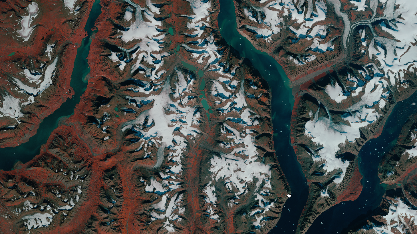
The new up to date orthophoto mosaics based on the latest satellite imagery from the Airbus Spot 6/7 satellites will contribute to address this gap by providing a fresh view of the ice-free areas of Greenland.

Project highlights:

Provision of very high resolution satellite imagery covering 225.000 km2 of Greenland

Advanced large scale data processing to produce seamless cloud-free, orthorectified and color optimized image mosaics covering the entire 225.000 km2.

Independent advice and support on satellite data selection and processing, drawing upon more than 20 years’ experience

In more detail..

Since 2015, DHI GRAS has supported the Danish Agency for Data Supply and Efficiency (SDFE), in close cooperation with Greenland’s Government, in their mission to provide updated topographic maps of the ice-free areas of Greenland.

The current topographic maps of Greenland are based on data collected in the 1930s and 1970-80s and they are inaccurate both in terms of elevation, distance and geolocation. However, Greenland is a large country and combined with the extreme conditions, dark polar winters and frequent cloud cover makes it difficult and costly to map at scale through traditional means.

Through previous pilot projects (undertaken in collaboration with Airbus on behalf of SDFE), we have provided ready-to-use orthomosaics and detailed Digital Elevation Models (DEM) for an area covering 85.000 sqkm of Greenland, successfully demonstrating the viability and potential of satellite imagery as a solution to the existing data gap.

In this project (in collaboration with Airbus) we will deliver updated satellite ortho image mosaics for the majority of the ice-free areas of Greenland – covering an extent of more than 225.000 km2.

These new data, providing a fresh view of Greenland, will underpin efforts to update existing topographic maps, thus contribute to support informed decision making and make it easier and more secure to navigate in the vast Greenlandic nature.

In partnership with

Danish Agency for Data Supply and Efficiency:

The Danish Agency for Data Supply and Effeciency (SDFE) provides high-quality data to the public and private sectors, enabling them to make important community decisions on the best possible basis.

SDFE is an agency that spans broadly across public administration and is part of the Danish Ministry of Climate, Energy and Utilities.

Related items

EOatDHI part of the DHI GROUP

gras@dhigroup.com
+45 4516 9100

Agern Alle 5,
2970 Hørsholm,
Denmark

CVR: 36466871