Mapping and measuring water depths from space to monitor constantly changing coastal environments . . .
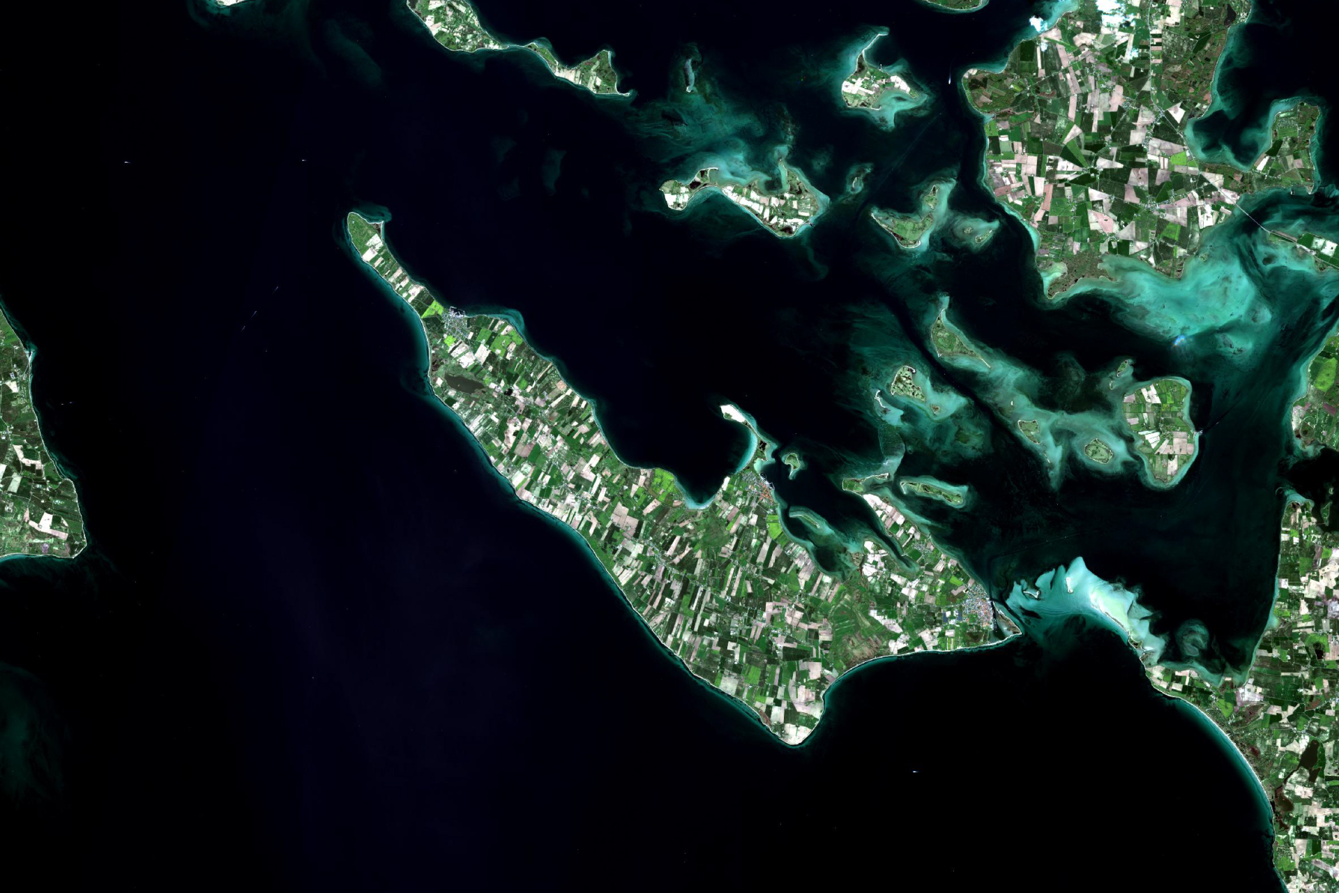
Satellite-derived Bathymetry
Mapping and measuring water depths from space
Why is it important?
Coastal environments are some of the most dynamic and constantly changing regions of the globe. Monitoring and mapping these changes is critical to environmental studies and construction activities such as harbours, pipelines and other critical infrastructure in the coastal zone and shallow off-shore areas.
A significant part of the worlds coastal region is still poorly mapped, or the mapping is significantly outdated. Navigating in poorly mapped or dynamic areas can be supported with up-to-date satellite-derived water depths.
The quick turnaround allows for quick delivery of up-to-date information as support to time-critical situations such as disaster relief following natural disasters where existing map material may have become outdated.
How does it work?
At DHI GRAS, we have developed a cost-effective method for accurate water depth mapping based on high resolution satellite images. Based on over 10 years of research and project activities we have developed an approach that exploits all the newest satellite systems.
Our proprietary state-of-the-art physical modelling method secures highly accurate deliveries. The approach is globally applicable, and we have helped clients all over the world from the polar regions to the tropics.
Satellite-derived bathymetry is a cost-effective approach to detailed mapping of the worlds shallow areas. Unlike field-based surveys the solution has a quick turnaround, no health and safety issues and requires no permits.
Since it is based on satellite information it is also ideal for remote areas and harsh environments.
What you get!
Very detailed mapping of the coastal and nearshore area in 2 to 10 meter spatial resolution
Very fast turn-around time no matter the location
Our proprietary methods and rigorous quality assessment ensures high quality data deliveries
Senior Project Manager,
Niras
Klavs Bundgaard
NIRAS has used high resolution bathymetry data from DHI GRAS for a detailed wave and water level study in Denmark. The bathymetry data was derived from satellites in an impressive high resolution. With the surface coverage, it was possible to see detailed morphological variations such as longshore bars, sand waves and other similar features, which are not normally seen in traditional measurements with that level of detail. It clearly made the subsequent modelling much more valid. The product is price-wise very competitive compared to traditional survey methods.
Typical customers?
Widely used by the modelling community where accurate bathymetry is required for any high quality hydrodynamic modeling of the coastal zone
Engineering companies working in the coastal zone use our data in the initial planning phase and as a first screening before conducting costly field campaigns
National authorities and hydrographic offices get up-to-date information about territorial waters and minimize navigational hazards within their area of responsibility
Specifications
We are industry leading providers of satellite-derived bathymetry
Our solution is based on more than 10 years of research and development funded by European Commission, European Space Agency, national authorities and internal funds
We have a proven track record with satisfied clients all over the world
We have a fast turn-around on all deliveries
We offer a cost efficient and industry leading high-quality product
Globally applicable where conditions allow it
All data undergo a very thorough quality
Every data point comes with an associated derived uncertainty measure
Price list
Available resolutions:
2-m resolution
10-m resolution
Price range depends on size of Area of Interest
Contact us for details and custom quotes