SAR4SAR – Enhancing Arctic Search and Rescue operations using radar satellite imagery

Why is it important?

Maritime activity across the Arctic is increasing together with increased economic activity and geopolitical awareness in the region. The increased traffic is mainly due to fishing, bulk carrier traffic, mineral exploration activities, cruise tourism but also an increasing need for sovereignty enforcement capabilities. Adding to this, local traffic, of which smaller fishing vessels, recreational boating, and local tourist operators are the main purposes.

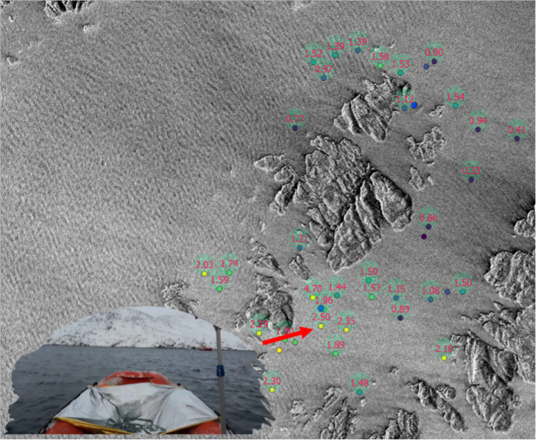
Consequently, supporting safety at sea, safeguarding national sovereignty as well as offering support to the civil society, efficient and capable naval and first responding capacities are being important as ever before to Arctic societies and nations. As examples of this, in Greenland alone, every year more than 50 search-and-rescue operations take place, where smaller boats and dinghies (dark-vessels) are involved.

Also, cruise tourism in the Arctic is expected, post-COVID-19, to attract even more tourists. These cruise ships often carry well over 500 passengers and in the event of an emergency situation where life rafts have to be used, there will be a pronounced need to provide an overview of the positions of these rafts, as they can quickly spread over large areas, due to rough environmental conditions.

All in all, the increased Arctic maritime traffic constitutes an increasing safety risk element, which is why increased capabilities concerning the location of small maritime objects and dark-vessel detection are required.

Project highlights:

Exploring how Danish companies within the marine, security and defense sectors can contribute with solutions increasing the visibility of small maritime objects in radar satellite images.

Feasibility live tests of equipment and tech solutions under Arctic conditions, securing Arctic-fit solutions.

Bridging scientific and industry knowledge and experience, safeguarding scientific and industry excellence and requirements.

In more detail..

Maritime activity across the Arctic is increasing together with increased economic activity and geopolitical awareness in the region. Supporting safety at sea, safeguarding national sovereignty as well as offering support to the civil society, efficient and capable naval and first responding capacities are being important as ever before to Arctic societies and nations and a clear need for enhanced navigational situational awareness exists.

Adding to this, communication opportunities in the Arctic are often limited outside the populated areas, due to vast distances and lack of communication infrastructure. In the case of dark-vessel-detection, e.g. for search-and-rescue operations, navies and first responders often have to search vast areas with little opportunity to efficiently identify the exact location of those in need in the often harsh environmental conditions.

Satellite-based decision support allows among other things efficient object identification within large areas. However, satellite-based object identification in the Arctic is challenged by a number of factors, including cloud cover, limited sunlight much of the year as well as large geographical areas, and widespread lack of up-to-date coastal information. SAR (Synthetic Aperture Radar) based sensors utilize microwave reflection against a given surface and can thus operate independently of cloud cover and light conditions, which is why SAR-based satellite data is particularly suitable under Arctic conditions.

The challenge of object identification in connection with search-and-rescue operations using SAR satellite data is that publicly available, e.g., Sentinel 1 from the European Space Agency (ESA), does not offer a sufficiently high spatial resolution to determine objects smaller than about 20m. In addition, the temporal resolution is also too low (3-5 days return visit time) to provide near-real-time data.

Due to recent and substantial expansion in commercial satellite constellation capabilities, it is possible to obtain high temporal and spatial resolution radar satellite data. However, detecting small maritime objects and dark vessels remains a challenging task and therefore SAR4SAR will explore how these challenges can be overcome by combining research and industry knowledge and tested in a live environment.

Center for Defence, Space & Security:

The Center for Defence, Space & Security (CenSec) is the prime Danish cluster for small and medium-sized enterprises specializing in high tech industries like defence, homeland security, space, aerospace, railway and maritime.

CenSec was founded in 2004 and established in 2007 as an industrial cluster. In 2018, CenSec was approved by the Danish Ministry of Higher Education and Science to also become a national Innovation Network for Security (Inno-Sec)

Related items

AI4ALERT

Developing novel geointelligence solutions to underpin security and defence related needs and requirements

Read More

Global Seas

Delivering earth observation enriched high-quality metocean data to enhance fuel efficiency in the shipping industry. . . .

Read More

EOatDHI part of the DHI GROUP

gras@dhigroup.com
+45 4516 9100

Agern Alle 5,
2970 Hørsholm,
Denmark

CVR: 36466871

Satellite-derived Bathymetry

Why is it important?

Coastal environments are some of the most dynamic and constantly changing regions of the globe. Monitoring and mapping these changes is critical to environmental studies and construction activities such as harbours, pipelines and other critical infrastructure in the coastal zone and shallow off-shore areas.

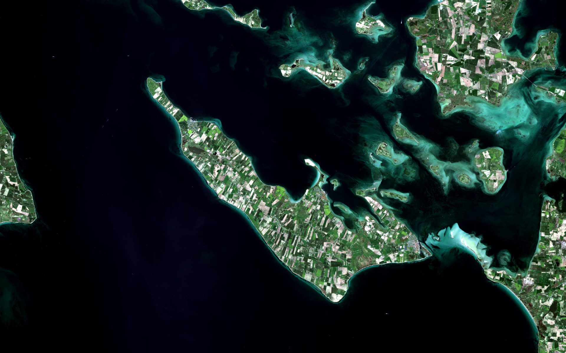
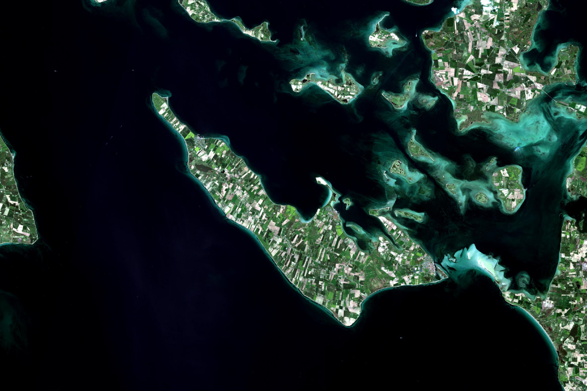
A significant part of the worlds coastal region is still poorly mapped, or the mapping is significantly outdated. Navigating in poorly mapped or dynamic areas can be supported with up-to-date satellite-derived water depths. The quick turnaround allows for quick delivery of up-to-date information as support to time-critical situations such as disaster relief following natural disasters where existing map material may have become outdated.

How does it work?

At DHI GRAS, we have developed a cost-effective method for accurate water depth mapping based on high resolution satellite images. Based on over 10 years of research and project activities we have developed an approach that exploits all the newest satellite systems.

Our proprietary state-of-the-art physical modelling method secures highly accurate deliveries. The approach is globally applicable, and we have helped clients all over the world from the polar regions to the tropics.

Satellite-derived bathymetry is a cost-effective approach to detailed mapping of the worlds shallow areas. Unlike field-based surveys the solution has a quick turnaround, no health and safety issues and requires no permits.

Since it is based on satellite information it is also ideal for remote areas and harsh environments.

What you get!

Very detailed mapping of the coastal and nearshore area in 2 to 10 meter spatial resolution 

Very fast turn-around time no matter the location

Our proprietary methods and rigorous quality assessment ensures high quality data deliveries

Senior Project Manager,
Niras

Klavs Bundgaard

NIRAS has used high resolution bathymetry data from DHI GRAS for a detailed wave and water level study in Denmark. The bathymetry data was derived from satellites in an impressive high resolution. With the surface coverage, it was possible to see detailed morphological variations such as longshore bars, sand waves and other similar features, which are not normally seen in traditional measurements with that level of detail. It clearly made the subsequent modelling much more valid. The product is price-wise very competitive compared to traditional survey methods.

Typical customers?

Widely used by the modelling community where accurate bathymetry is required for any high quality hydrodynamic modeling of the coastal zone

Engineering companies working in the coastal zone use our data in the initial planning phase and as a first screening before conducting costly field campaigns

National authorities and hydrographic offices get up-to-date information about territorial waters and minimize navigational hazards within their area of responsibility

Specifications

We are industry leading providers of satellite-derived bathymetry

Our solution is based on more than 10 years of research and development funded by European Commission, European Space Agency, national authorities and internal funds

We have a proven track record with satisfied clients all over the world

We have a fast turn-around on all deliveries

We offer a cost efficient and industry leading high-quality product

Globally applicable where conditions allow it

All data undergo a very thorough quality

Every data point comes with an associated derived uncertainty measure

Price list

Available resolutions:

2-m resolution

10-m resolution

Price range depends on size of Area of Interest

Contact us for details and custom quotes

Visit us at our bathymetry data portal

EOatDHI part of the DHI GROUP

gras@dhigroup.com
+45 4516 9100

Agern Alle 5,
2970 Hørsholm,
Denmark

CVR: 36466871
Digital Elevation Model

Why is it important?

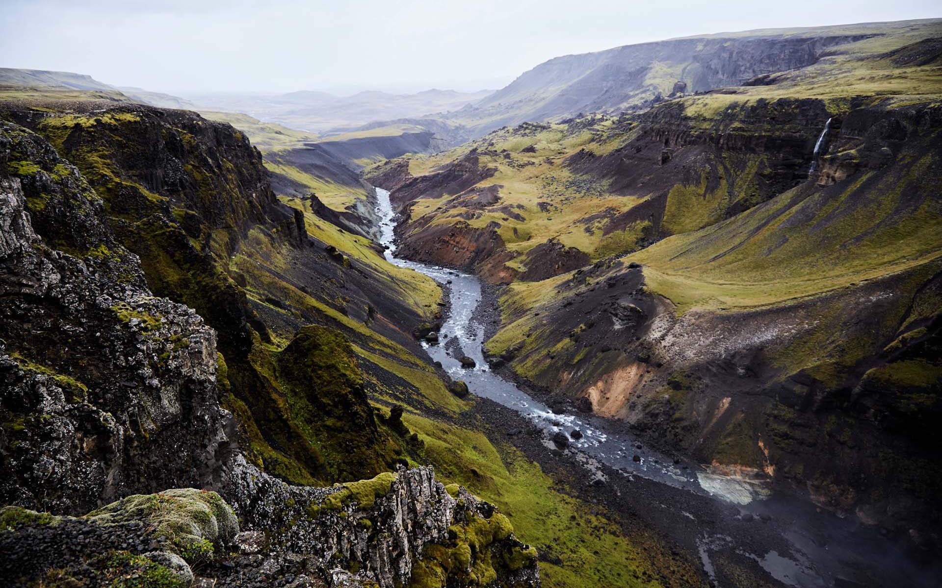
A DEM enables you to understand all aspects of the terrain and is an essential input in many geospatial analyses such as topography mapping, hydrological modelling, airspace planning, infrastructure site planning’s and environmental change applications.

An elevation model derived from satellites will overcome challenges related to the insufficient detail level in public available DEM’s such as SRTM, as well as being a more cost-efficient alternative to LiDAR and land surveyor based DEM’s.

How does it work?

A Digital Elevation Model (DEM) is a digital representation of the earth’s terrain heights.

We provide DEM’s created from stereoscopic satellite imagery, which is a highly cost-efficient alternative to traditional land and aerial based surveying approaches. A DEM can be used to derive topographic contours and compute elevation slope, aspect and other topography characteristics used in many geospatial analyseis.

A DEM can be delivered as both a digital surface model (DSM) which includes surface features such as vegetation and man-made structures, as well as a bare-earth representation without above ground objects (DTM) – both options ranging from 50 cm to 30 m in spatial resolution

What you get!

Updated and tailormade Digital Elevation Model (DTM/DSM), delivered in any ready-to-use GIS format

Possible additional data layers such as contour lines, hydrological enhancements, satellite imagery

Our independent and qualified advice on selecting the right solution suited to your project requirements

Typical customers?

Hydrological modelers work with DEM’s for flood modelling

Aerial operators (e.g. UAV and airplane pilots) need accurate terrain heights to safely plan their flight

Wind resource modelers need accurate terrain heights to estimate onshore wind resources

Specifications

Delivery time: Some products are ready to go, others need a bit more processing time

To further enhance the accuracies of the DEM, a few ground control points (GCP) is very often beneficial

We will assist with experience and guidance

Price list

Typical pricing:

1m DEM: 60-90 EUR/sqkm

4m DEM: 30-50  EUR/sqkm

Minimum order size: 100 sqkm

EOatDHI part of the DHI GROUP

gras@dhigroup.com
+45 4516 9100

Agern Alle 5,
2970 Hørsholm,
Denmark

CVR: 36466871

World Hydrography Day

World Hydrography Day:

22 June 2018

At DHI GRAS, we value the sustainability of seas, oceans and waterways, which this year is marked by World Hydrography Day with the theme "Bathymetry - the foundation for sustainable seas, oceans and waterways".

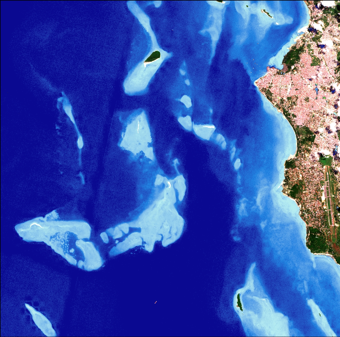
At DHI GRAS, we use satellites to derive bathymetry data from all over the world. A significant part of the global underwater coastal zone is still unmapped or subject to dynamic changing seabed features. This makes it difficult for ships to navigate safely, and is a big cause for concern for both human lives and potential environmental disasters from groundings. We are working to minimise these risks.

We are a leading global provider of satellite-derived bathymetry, and with modern satellites and advanced physical modeling of the water column, it is possible to derive reliable water depths in shallow waters at low costs with no risks associated.

Zanzibar
Copyright: DHI GRAS, contains modified Copernicus Sentinel data (2018)

EOatDHI part of the DHI GROUP

gras@dhigroup.com
+45 4516 9100

Agern Alle 5,
2970 Hørsholm,
Denmark

CVR: 36466871