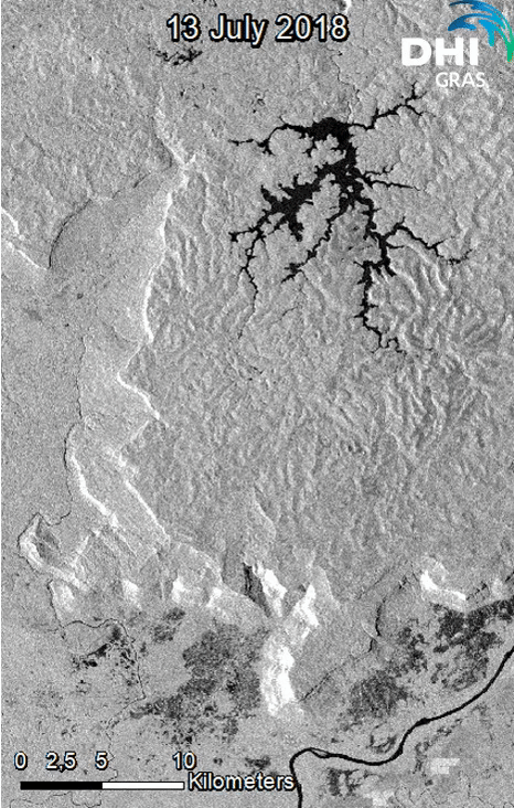
Thousands affected after the collapse of the Xepian-Xe Nam Noy hydroelectric dam in southeast Laos. The billion-dollar hydropower project was still under construction when the breach occurred Monday evening local time, unleashing approximately 5 billion cubic meters of water onto the surrounding countryside, with many living close to the river system that feeds into the failed dam.
Laos aims to become the “battery of Asia” by selling power to neighbouring countries through a series of hydropower projects and plans to be operating 100 plants by 2020.
Sentinel-1 RADAR imagery has captured the dam on the 13th and 25th of July, showing the state of the area before and after the dam collapsed. The resulting flood is illustrated in blue and the empty reservoir in orange.
Copyright: DHI GRAS, contains Copernicus Sentinel data (2018)
International Day for the Conservation of the Mangrove Ecosystems:
16 July 2018
Did you know that:
- Mangroves reduce vulnerability to climate-related coastal hazards and ensure shoreline stabilization
- Mangroves provide habitats for many threatened species
- Mangroves are some of the most carbon-rich ecosystems
- Mangroves provide food security by sustaining fisheries and forest products for thousands of coastal communities
The stakes are high seeing as mangroves are among the most threatened ecosystems on earth with estimates indicating that up to 67% of mangroves have been lost to date.
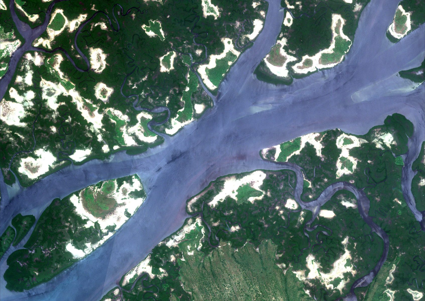
DHI GRAS is leading the ESA funded GlobWetland Africa initiative which looks at exploiting the increasing capabilities of satellite observations to support the inventory, monitoring and assessment of mangroves. The project aims to provide African stakeholders with tools to effectively manage and conserve areas such as mangroves.
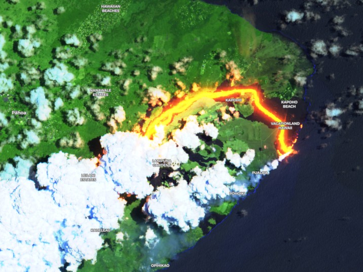
The ongoing eruption of Hawaii’s Kilauea Volcano continues to spew out lava and engulf more and more land.
The volcano is one of the most active in the world, and has already destroyed hundreds of homes and most recently injured 23 tourists that sailed too close to the flowing lava.
Sentinel-2 images in false color shows how the lava has flowed from the rift into Vacationland wiping out almost the entire neighbourhood and altering the landscape by moving the shoreline almost 1 km from its original location.
Drought is a major cause of limited agricultural productivity and of crop yield uncertainty. This is exactly why early detection of drought is important for managing crops to prevent and mitigate crop losses and prevent wild fires. Most of Europe is already seeing the consequences of the ongoing drought with a loss of crops and fires starting. To manage large areas, it can therefore be an advantage to use satellite images.
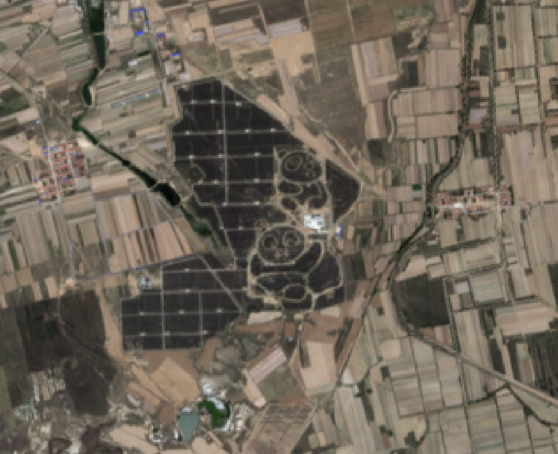
Spotted: A solar farm in China shaped as pandas (captured by Sentinel-2).
The panda-shaped solar farms aim to support the development of renewable energies and to promote public awareness on eco-friendly technologies and sustainable development, in particular among young people.
Copyright: DHI GRAS, contains Copernicus Sentinel data (2018)
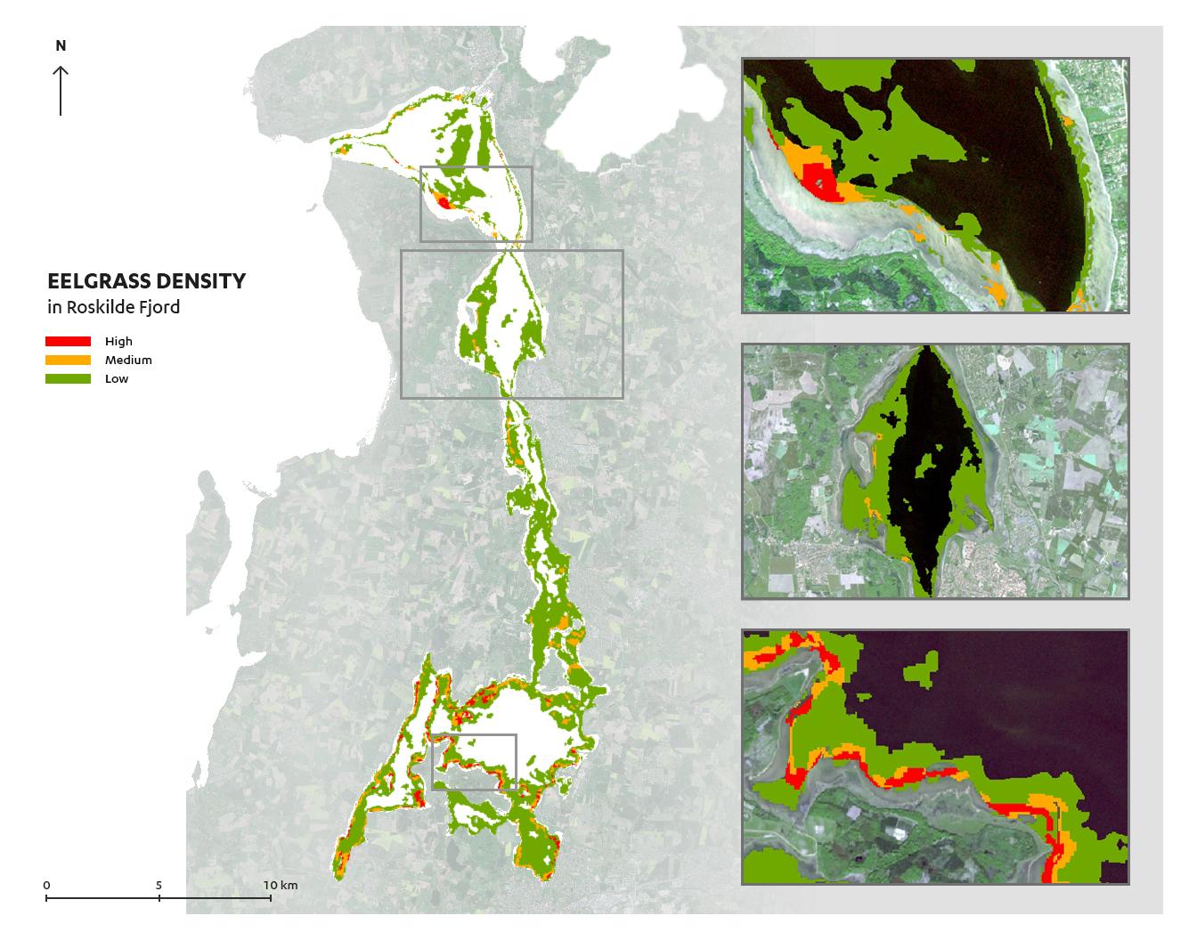
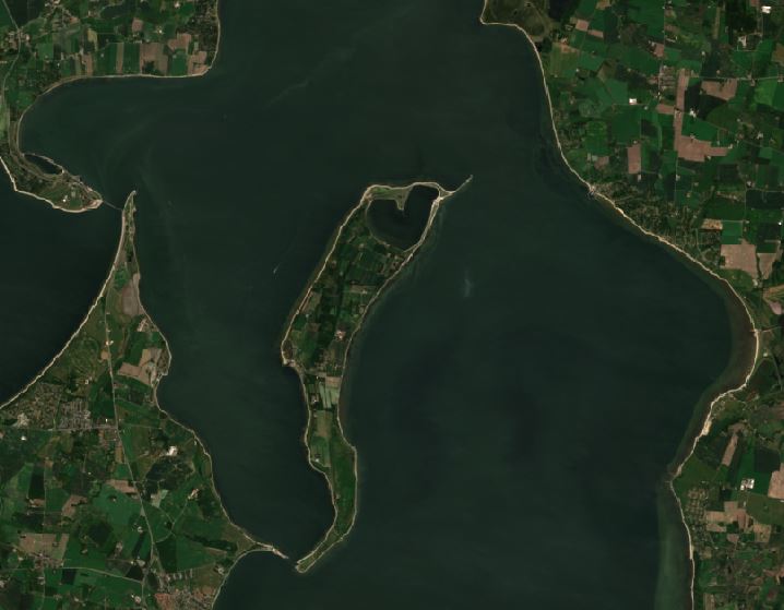
One of our own, James Ormond Fethers, recently graduated from Aalborg University Copenhagen with a master’s degree in Geoinformatics. James worked alongside remote sensing experts in DHI GRAS for his master thesis on classification of eelgrass in Roskilde Fjord using Sentinel-2 imagery.
Eelgrass is a significant and fragile species of seagrass that is commonly found in Denmark and the Northern Hemisphere, and the coverage and depth limit can be used for evaluating the ecological condition of coastal waters.
Satellite remote sensing has the potential to improve the cost effectiveness of this analysis significantly by measuring coverage and directing field surveys to determine the depth limit.
James will be speaking at “Kortdage 2018” in Aalborg on the 14th-16th of November, where he will introduce and demonstrate his thesis in more detail. Stay tuned ..
These days the largest North European culture and music festival is taking place.
The festival covers an area that corresponds to 350 football fields, with around 130,000 participants moving in for the week-long party making Roskilde Festival the fourth largest city in Denmark in terms of population.
Sentinel-2 has captured the area on the 4th of June (before the festival started) and again on the 4th of July (four days into the festival).
Can you spot orange stage?
*Notice how the drought has turned the surrounding fields from green to brown.
Our very own junior geoinformatic specialist, Mike, just graduated from Aalborg University Copenhagen with a master’s degree in Geoinformatics.
His master thesis was done in close collaboration with our remote sensing experts here at DHI GRAS using Sentinel-2 imagery.
One main challenge for satellite imagery analysis is cloud cover, especially when working with time sensitive objects such as crop type classification and crop yield estimation.
Mike looked at how the implementation of image composites could be beneficial for cloud-free crop type monitoring and classification and found that creating monthly composites provided an increase of 23.5% in the total number of fields available for classification in the area of interest.
On a wider scale, the composites provide a big opportunity for monitoring and classification of land cover and land use in cloudy and rainy areas, such as the wet season in Africa or South-East Asia and could make crop yield estimates more reliable.
Below you can get an idea of how piecing together images from different days with differing cloud cover can result in an almost cloud-free image to do the further analysis on.
International Day of the Tropics was celebrated on the 29th of June. This is a region that faces a number of challenges such as deforestation, logging, urbanization and demographic changes and is particularly vulnerable to droughts, floods and storms as climate change accelerates.
Did you know that:
- The Tropics account for 40% of the world’s total surface area and are host to approximately 80% of the world’s biodiversity
- The Tropics host nearly 95% of the world’s mangrove forests by area and 99% of mangrove species
- The Tropics have just over half of the world’s renewable water resources and yet almost half of their population is considered vulnerable to water stress.
At DHI GRAS, we have several projects with pilot sites located in the Tropics, where we help to develop and demonstrate how earth observation can benefit sustainable development in a number of different ways.
Curious to know more?
Read about our EO4SD initiative (http://eo4sd.esa.int/) or the GlobWetland Africa project (https://lnkd.in/dziDPN6).
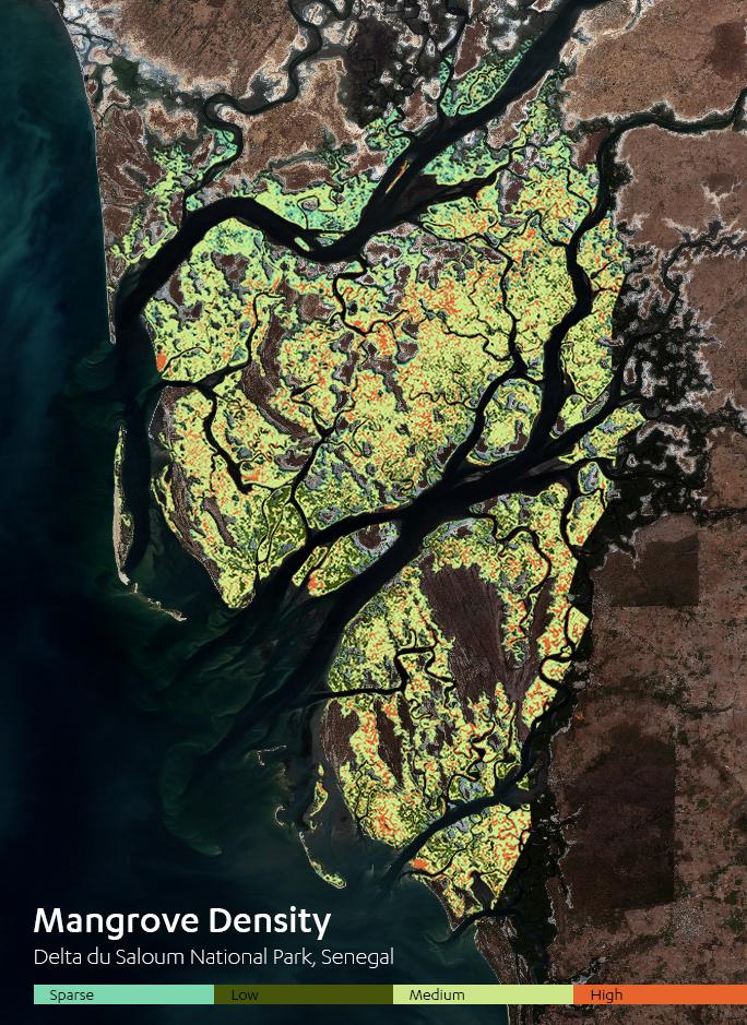
Delta de Saloum National Park, Senegal Copyright: DHI GRAS, contains modified Copernicus Sentinel data (2018)
We have provided a case for the “Brug rummet” initiative under the Ministry of Education and Research, which focuses on the uses of space technology. Read about it here (in Danish)