Developing and operationalizing agricultural monitoring system for the Danish Agricultural Agency
A national scale satellite based monitoring system that uses Earth observation and machine learning to monitor agricultural activities across Denmark in near real time, supporting EU Common Agricultural Policy compliance and subsidy payments.
Why is it important?
EU agricultural subsidy schemes involve substantial public funding and require transparent, consistent, and reliable monitoring of farming activities. Traditional field based inspections are costly, time consuming, and difficult to scale when monitoring hundreds of thousands of agricultural parcels nationwide. Satellite based monitoring enables a fundamental shift in how agricultural controls are conducted. By providing objective, harmonised, and frequently updated information on land use, land cover, and agricultural practices, authorities can improve efficiency, reduce administrative burden, and ensure fair and timely subsidy payments in line with EU CAP requirements.
Project highlights:
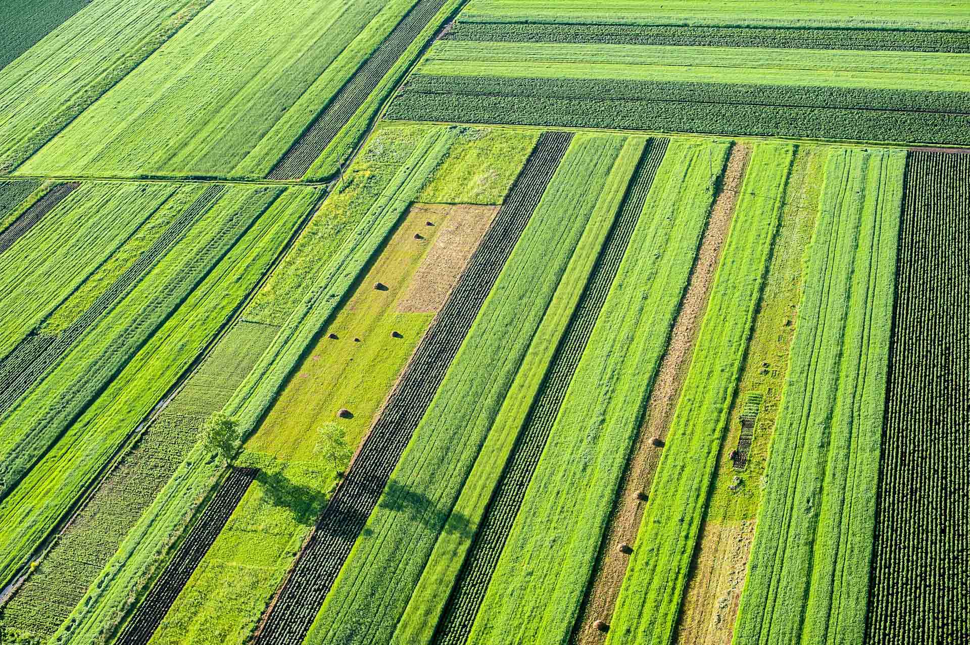
Continuous, wall‑to‑wall monitoring of all agricultural fields in Denmark using satellite imagery, enabling near‑real‑time observation of land use, land cover, and farming activities at national scale.
Advanced machine‑learning and image‑processing workflows translate Earth observation data into actionable indicators for EU Common Agricultural Policy (CAP) compliance, replacing manual inspections with objective, data‑driven evidence.
Direct integration of satellite‑derived insights into the Danish Agricultural Agency’s operational systems, supporting transparent and efficient administration of EU agricultural subsidies exceeding EUR 800 million annually.
In more detail..
Since 2016, DHI has worked in close collaboration with the Danish Agricultural Agency (DAA) to develop and operationalise a frontrunning satellite based monitoring solution for the EU Common Agricultural Policy.
This long term partnership has proven to be a recipe for success, positioning Denmark as a trendsetter in public digitalisation and enabling full national scale operational use since 2019.
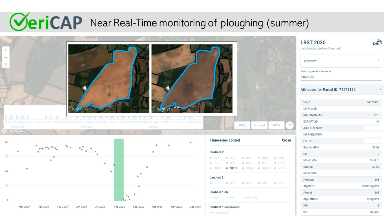
The CAP monitoring solution builds on DHI’s long standing expertise in satellite based agricultural monitoring. The technical backbone of the system is VeriCAP, which provides a streamlined, flexible, and accurate Check by Monitoring (CbM) and Area Monitoring System (AMS) solution. VeriCAP enables continuous monitoring of crop types and farm management practices in accordance with EU CAP rules and requirements, using Earth observation data combined with advanced image analysis techniques.
In 2019, the solution was successfully piloted at national scale in Denmark, demonstrating its capacity to monitor approximately 600,000 agricultural fields at 10 metre spatial resolution. Since 2020, the system has been fully operational as a running service, with satellite‑based information automatically integrated into the Danish Agricultural Agency’s IT systems and operational workflows. Today, it supports the administration of agricultural subsidy payments exceeding EUR 800 million annually. Denmark is widely regarded as a frontrunner in large‑scale implementation of satellite‑based CAP monitoring.
Together with the Danish Agricultural Agency, we have been among the first to establish a fully operational national‑scale system. At the same time, the Danish experience highlights that effective CAP monitoring solutions must be tailored to each country’s specific administrative practices, regulatory interpretations, and implementation models within the EU framework..
The approach has enabled the Agricultural Agency to harmonise existing monitoring frameworks, significantly reduce the need for physical field visits, increase effectiveness, and lower administrative costs. In recognition of its impact and its ability to exploit the potential of digitalisation to improve public administration, the solution received the Innovation Award at the Danish Digitalisation Awards in September 2021.
The Danish Agricultural Agency:
The project is delivered by DHI under a multi year contract with the Danish Agricultural Agency, supporting national implementation of the EU Common Agricultural Policy through satellite based monitoring and digitalised control workflows.
Related items
Preparing for the future of the Common Agricultural Policy
Preparing for the future of the Common Agricultural Policy : 06 February 2019 An example
Monitoring agricultural fields with satellite images
Satellite-based monitoring for national screening of agricultural fields parameters to support the Danish authorities .