Fresh views on Greenland – updated satellite imagery successfully delivered

Fresh views on Greenland – updated satellite imagery successfully delivered

25 MARCH 2021

Topographic maps of Greenland are generally not up to date and the positional accuracy is often inadequate in the breathtaking landscapes outside the main settlement areas. This means that decisions related to public administration, environmental regulation and the potential for economic development are often based on data and maps that may be inaccurate, and this can seriously impede decisions based on these data.

This situation is about to change very soon though, as the Danish government (Through the Agency for Data Supply and Efficiency (SDFE)) has asked for help from space.

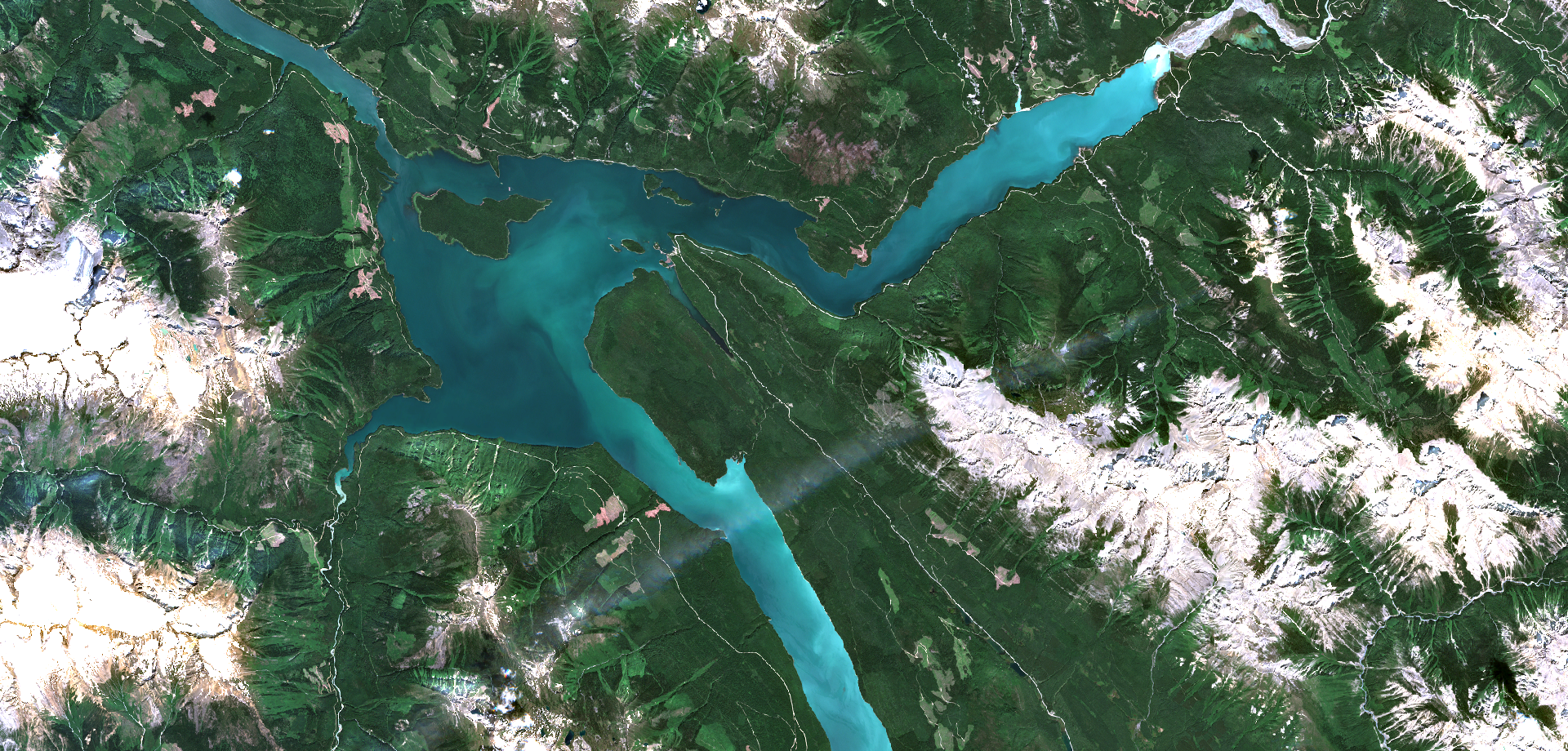
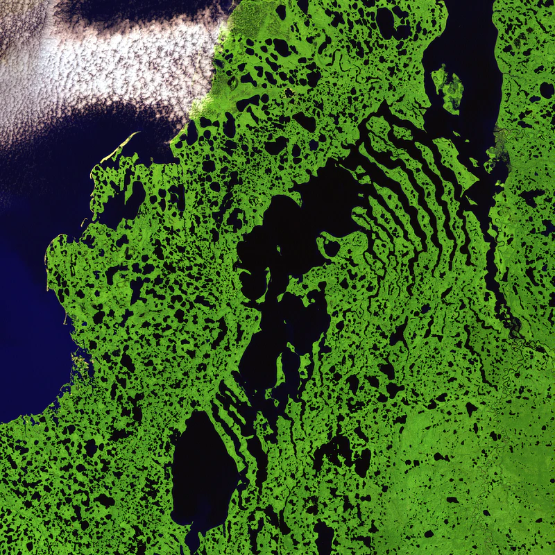
In close collaboration with SDFE and our partners in Airbus Defence and Space , we have processed vast amounts of updated SPOT 6 and 7 satellite imagery covering 225.000 sq.km of Greenland, in a very short time. We have turned these data into cloud free, orthorectified and color optimized image mosaics in 5 different parts of Greenland. The results are fresh views of the astonishing landscape of Greenland.

Stay tuned for updates on getting access to the imagery, which will be freely available very soon

Cookies

Cookie Policy

This cookie policy covers www.dhi-gras.com.

DHI GRAS A/S, our suppliers and business partners use cookies to provide the best possible service to our website users. How we handle the use of cookies is set out in this Cookie Policy.

Our Privacy Policy describes how we use the personal data that our cookies collect about you when you visit our website.

Owner and contact information:

DHI GRAS A/S
Agern Alle 5
2970 Hørsholm
CVR no: 25621646

+45 4516 9100
GDPR-security@dhigroup.com

What is a cookie?

A cookie is a data file that a website stores on your IT equipment such as your computer, tablet or smartphone. The object is to recognise your IT equipment and observe how you use the website.

Almost all websites use cookies. Cookies are often required to provide the correct standard of service at the website. A cookie is a passive file that cannot collect information stored on your computer or spread any computer virus or other harmful programs.

Some cookies are stored on your device only as long as you have your browser open (session cookies). Other cookies are stored on your device for a longer period of time (persistent cookies). When you return to a website, the cookie is automatically renewed.

Often cookies from parties other than the party owning the website are stored on your device (third-party cookies). These may be cookies with ordinary contents, but also analysis tools and embedded comment fields.

This Website also uses cookies. We will not store cookies on your device before you allow us to, besides strictly technical cookies that are necessary to make the site operate. However, not accepting the storage of cookies on your device may result in the Website not functioning optimally and that certain features cannot be used, such as our video player.

Why do we use cookies?

In some cases, the use of cookies is the only way in which our Website can function as intended. Furthermore, cookies can help us get an overview of your visits to our Website so that we can continually tailor your user experience and so that we may improve the Website. For example, cookies remember whether you have visited the Website previously.

The collected information is anonymous and non-personally identifiable. However, cookies may, depending upon the circumstances, be used to identify you indirectly when the collected information is combined with other information. We will not attempt to make such identification, but were this does happen, the information will be treated as personal data in accordance with our Privacy Policy.

What types of cookies do we use on our Website, and what is the purpose?

First party cookies:
DHI GRAS A/S as a first party may use the following types of cookies:

Strictly necessary
Strictly necessary cookies help make a website navigable by activating basic functions such as page navigation and access to secure website areas. Without these cookies, the website would not be able to work properly.

Functional
Functional cookies make it possible to save information that changes the way the website appears or acts. For instance your preferred language or region.

Statistical
Statistical cookies help the website owner understand how visitors interact with the website by collecting and reporting information.

Marketing
Marketing cookies are used to track visitors across websites. The intention is to display ads that are relevant and interesting to the individual user and thus more valuable for publishers and third-party advertisers.

Unclassified
Unclassified cookies are cookies in the process of being classified as either technical and necessary, functional, statistical or marketing. We are in the process of classifying unclassified cookies together with the providers of the individual cookies.

Third-party cookies
You can share content from our Website on social networks such as Facebook, LinkedIn and Twitter. You can expect that social networks store cookies. Which and for what purpose differs from network to network, but it is the provider of the given network that is responsible for informing about the storage of these cookies and ensuring your consent. We also have collaborators who store cookies through our Website and have access to information collected by cookies sent from our Website, including Google Analytics. The identity of such third parties is stated in the cookie declaration.

How long are cookies stored?

The cookie's life span may vary depending on what the individual providers have set them at. Some cookies disappear as soon as you close the browser window, others may exist for several years. Many providers typically use a 12- or 24-month life span on their statistical-, advertisement-, and content related cookies. The life span is prolonged after each visit. Accordingly, we will store your personal data for up to two years from the date on which we registered your visit on our website. The specific storage period depends on the individual cookie.

How do you delete or disable cookies?

You can change your cookie settings or withdraw your consent at any time by clicking the cookie icon at the lower left corner of this Website. If you do not consent to cookies, it can result in parts of the Website not functioning or appearing properly.

Likewise, you can delete previously stored cookies. The procedure for deleting cookies on your device depends on the browser and the device you are using. If you are using a PC, you may delete cookies by using the keyboard shortcut [CTRL]+[SHIFT]+[Delete]

If this procedure is not successful or if you are using a Mac computer, iPad, iPhone etc. please follow the guidelines via the following links depending on the browser you are using:

Ask us if you have questions

If you have any questions about cookies, or our cookie information and processing of personal information, please contact us at GDPR-security@dhigroup.com.

The actual cookie banner is provided and updated every month by Cookie Information ApS, and if you have any questions or technical issues with it, please write to support@cookieinformation.com.

EOatDHI part of the DHI GROUP

gras@dhigroup.com
+45 4516 9100

Agern Alle 5,
2970 Hørsholm,
Denmark

CVR: 36466871

NextLand

Why is it important?

More efficient use of water, and other inputs, in agriculture is gaining importance with recent attention to sustainable resource use. By providing timely, accurate and field-scale information on the crop water use and crop water needs we can help farmers to optimize their practices with both economic and environmental benefits.

Project highlights:

Satellite data can be used to operationally produce potential and actual evapotranspiration maps.

Actionable information, such as crop water deficit, can be used by farmers to improve their irrigation practices.

NextLand store will allow easy access to produced maps through a modern user and machine-to-machine interfaces.

In more detail..

With the Copernicus Earth observation program reaching a mature stage, the time is right to develop operational commercial services based on this high-quality data. This is the aim on the NextLand project, with the focus on agricultural and forestry EO services. At DHI GRAS we have been developing advanced methods to estimate actual and potential evapotranspiration using data from the Copernicus Sentinel satellites and infer crop water needs based on this information. This is the expertise which we are bringing to the NextLand consortium. Through co-creation with selected group of agricultural alpha-users we will fine-tune our evapotranspiration-based products and offer a valuable tool for optimizing irrigation practices with benefits both to the farmers and the environment.

European Commission:

NextLand is funded by the European Union’s H2020 Programme for Research, Technological Development and Demonstration.

H2020 is the biggest EU Research and Innovation programme and a financial instrument aimed at securing Europe’s global competitiveness by driving economic growth and focusing on research as an investment for the future of Europe.

EOatDHI part of the DHI GROUP

gras@dhigroup.com
+45 4516 9100

Agern Alle 5,
2970 Hørsholm,
Denmark

CVR: 36466871

Increasing Crop Water Use Efficiency at Multiple Scales Using Sentinel Evapotranspiration – ET4FAO

Why is it important?

With increasing pressure on fresh water resources, and up to 70% of those resources used in crop irrigation, it is important to monitor and improve crop water use efficiency from field to national scales.

Project highlights:

Evaporanspiration maps covering Lebanon and Tunisia were produced and are available from et4fao.dhigroup.com

Covering a wide range of metocean parameters with expert assessment of quality and only including sufficiently reliable data.

Robust scientific analysis of the new evapotranspiration products and maps available from WaPOR portal is conducted.

In more detail..

The Food and Agriculture Organization (FAO), the custodian agency of SDG indicators 6.4.1 and 6.4.2, is running a portal called Water Productivity Open-access portal (WaPOR) to encourage the use of satellite data in crop water use efficiency monitoring. The WaPOR portal currently relies on Terra and Aqua, PROBA-V and Landsat satellite data, many of which are at the end of their expected lifetime. In this project we perform robust, scientific analysis of the possibility to use Copernicus data (especially observations from the Sentinel-2 and Sentinel-3 satellites) in place of the legacy satellites, to produce national maps of evapotranspiration able to capture field-scale crop water use.

The project builds upon methodologies developed during the ESA-funded Sen-ET project. During that project, a robust method was developed to estimate land-surface energy fluxes, including evapotranspiration, at field-scale using Sentinel-2 and Sentinel-3 data, despite the absence of a high-resolution thermal sensor in the Sentinel constellation. The method consisted of a machine-learning data fusion algorithm for sharpening land surface temperature measured by Sentinel-3 at 1 km to the 20 m spatial resolution of Sentinel-2, followed by a physically based modelling of land-surface energy fluxes. In ET4FAO we apply this technique to produce evapotranspiration maps covering the whole of Lebanon and Tunisia at 20 m, 100 m and 300 m spatial resolutions. Those maps are then compared against products available from the FAO WaPOR portal and validated against independent field measurements.

European Space Agency:

The project in funded by ESA as part of the EO Science for Society Open Call. It is a partnership between scientists from DHI GRAS and COMPLUTIG (Spain) with FAO acting as the main stakeholder.

EOatDHI part of the DHI GROUP

gras@dhigroup.com
+45 4516 9100

Agern Alle 5,
2970 Hørsholm,
Denmark

CVR: 36466871

Marine vegetation mapping in Sweden

Why is it important?

According to the EU Habitat directive and the Marine Strategy Framework Directive, member states are required to map, monitor and evaluate changes in the quality and areal distribution of different marine habitats and biotopes. Submerged aquatic vegetation (SAV), in particular eelgrass, is one of the key indicators of ecological status and environmental state of water bodies, and therefore widely used in reporting related to these directives.

Project highlights:

Copernicus Sentinel-2 imagery, novel machine learning techniques and advanced data processing to create the first spatial overview of the distribution of SAV at national scale in Sweden.

A cloud-based web-application for Sentinel-2 based SAV mapping without prior specialist knowledge Input.

A training dataset constructed with more than 30 000 manually drawn polygons to build a robust machine learning model and predict nationwide SAV.

In more detail..

In 2020 we embarked on a project together with the Swedish regional and national authorities, to combine Copernicus Sentinel-2 satellite imagery, novel machine learning techniques and advanced data processing to create the first spatial overview of the distribution of SAV at national scale in Sweden. A training dataset constructed with more than 30 000 manually labelled polygons was used to build the classification model, with which more than 3800 km2 of the underwater habitats, of the entire shallow coastal zone of Sweden, was mapped. Applying Sentinel-2 imagery from 2019-2020, the resulting classification, in 10-meter spatial resolution, provides nationwide coverage and detailed insight into the status of aquatic vegetation in the shallow water areas of Sweden.

Moreover, in close coordination with the key stakeholders, we have developed a cloud-based web-application that enables individual counties along the Swedish coast to perform their own SAV mapping without prior specialist knowledge. This ties into a long-term objective of the counties in Sweden to easier comply with national monitoring and reporting requirements, and thereby for Sweden to better comply with international requirements at EU level.

The project outcome and methodologies are further described in the following peer-reviewed article:

Huber, Silvia. et al. (2021), Novel approach to large-scale monitoring of submerged aquatic vegetation: A nationwide example from Sweden. Integrated Environmental Assessment and Management.

Länsstyrelsen Västerbotten

Länsstyrelsen Västerbotten, on behalf of the Swedish Agency for Marine and Water Management.

EOatDHI part of the DHI GROUP

gras@dhigroup.com
+45 4516 9100

Agern Alle 5,
2970 Hørsholm,
Denmark

CVR: 36466871

EO Clinic: Snow and Ice Mapping in Kazakhstan

Why is it important?

The snowpack and its spatial and temporal variability play an important role in the hydrological cycle and water resource management of Kazakhstan, since most rivers and streams are fed by snow melt, which is the main water source for the vegetation growing season. Snow stores a significant mass of water and knowledge about the extent and amount of water provides important input for hydrodynamic models and the management of natural hazards, such as flood events. River ice controls the winter flow regime of rivers and compromises the operation of hydrometric stations, governs the water intake and discharge activities of municipalities and businesses. Particularly during spring, break-up ice can create jams and floods that endanger infrastructure such as bridges. EO based information could feed into a near real time monitoring system to support informed decision making.

Project highlights:

Possibility for near real-time monitoring systems for ice jam detection.

Improved forecasting of snowmelt runoff to inform flood warning tools.

Input for hydrodynamic models for informed decision making.

In more detail..

The Committee on Water Resources of the Ministry of Ecology, Geology and Natural Resources and the Committee for Emergency Situations of the Ministry of Internal Affairs has appointed the Kazakh space agency (Kazakhstan Gharysh Sapary - KGS) to provide solutions to mitigate flood-related hazards and risks. The application of Earth Observation (EO) data is a very efficient and cost-effective way to support flood protection programs. EO’s strength lies in its large-area and high-temporal monitoring capabilities of the Earth’s surface - information of direct relevance to better understand the water dynamics, flood occurrence and finally inform hydrodynamic models to improve flood simulations.

Despite its importance, snow cover, one of the Essential Climate Variables, is often underrepresented in such models. Snow stores a significant mass of water and, with its high dynamic, has a strong effect on regional and global energy and water cycles. Information of ice dynamics can inform tools to monitor risk-prone areas in near real time such as ice jams along rivers that potentially endanger infrastructure or provoke flooding.

In this project, DHI GRAS provided the following five products to KGS:

1. Snow Cover Extent The snowpack and its spatial and temporal variability play an important role in the hydrological cycle and water resource management of Kazakhstan, since most rivers and streams are fed by snow melt, which is the main water source for the vegetation growing season.

2. Snow Water Equivalent SWE represents the amount of water that is contained in a snowpack, i.e., the weight of the meltwater per square meter that would result if the snowpack was melted entirely. Information about SWE is needed in applications such as flood forecasting and irrigation planning.

3. Wet Snow Maps Maps of wet snow can be used as indicator for onset of snow melt and inform hydrodynamic models.

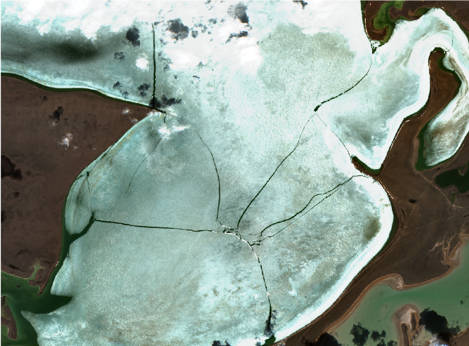
4. Ice break-up Ice break-up is an important hydrologic event with detriments, such as infrastructure damage and lost economic activity. Ice break-up is defined as a process with specific dates identifying key events between the onset of melt and the complete disappearance of ice.

5. Ice jam detection River ice controls the winter flow regime of rivers and compromises the operation of hydrometric stations, governs the water intake and discharge activities of municipalities and businesses. Particularly during spring break-up, ice can create jams and floods that endanger infrastructure such as bridges with large economic losses.

EO Clinic

This project was carried out in the framework of the EO Clinic, in partnership between ESA (European Space Agency), the Asian Development Bank (ADB).

The activity is carried out within the scope of the recent ADB Knowledge and support Technical Assistance (KSTA) focusing on streamlining the use of high-level technologies in Kazakhstan and aligned with the operational priorities for ADB country partnerships and the National Sustainable Development Strategy of Kazakhstan.

EOatDHI part of the DHI GROUP

gras@dhigroup.com
+45 4516 9100

Agern Alle 5,
2970 Hørsholm,
Denmark

CVR: 36466871

Public geodata and earth observation – new opportunities to support the Green transition

Public geodata and earth observation - new opportunities to support the Green transition

In early 2021, DHI GRAS participated in a hackathon organized by the Danish Business Authority, the Agency for Data Supply and Efficiency and the Danish Agency for Digitisation. The aim of the hackathon was to innovate and design new ways to make best use of publicly available geodata to support the Green transition.

Our dedicated team of data-hackers and developers worked intensively over two weeks to experiment and innovate with public geodata, such as aerial photos, LIDAR data, topographic vector data, environmental data, Sentinel satellite data and lots of other data sources.

In just two weeks we went from initial idea, through experimentation, innovation, and design of a new solution to count and quantify every green square-meter of Denmark (or whichever country with Green ambitions). In a few days we managed to produce a fully updated national forest map (extent and type) in high spatial resolution (10 meters) and developed and applied our Deep Learning models to automatically count and map small landscape elements such as single trees, hedges, and shrubs at centimeter scale – all key ingredients for data-driven decision making within biodiversity and forest management. Full steam ahead and looking forward to continuing our mission of using earth observations and innovative thinking to support the green transition.

Thanks to the organizers and not least our great team working on this! Stay tuned for more updates on how we use geodata to map and monitor the green state of Denmark.

The solution developed through the hackathon can be explored at https://greendenmark.dhigroup.com/ or by clicking the image below.