DHI GRAS to lead efforts to develop global level EO tools and data to strengthen water resource management

DHI GRAS to lead efforts to develop global level EO tools and data to strengthen water resource management

29 APRIL 2020

We are delighted to announce that DHI GRAS has been contracted by the European Space Agency (ESA), to lead a consortium consisting of GeoVille GmbH (Austria), GISAT (Czech Republic), GRID-Arendal (Norway) and the technical university of Denmark (DTU), in a large new application project: “WorldWater - Surface Water Dynamics”.

Water is essential for life on Earth and a critical natural resource that underpins all social and economic activity. During the last century, water consumption has increased twice as fast as the world’s population, and today water scarcity affects more than 40 percent of people globally – a disturbing figure which is expected to rise if we do not change our habits and respond to climate change and future global warming.

The dedicated goal on water in the 2030 agenda for sustainable development has brought a spotlight on water policy at global level, and in national planning, to avoid an accelerating ‘water crisis’ towards 2030. However, a ‘water crisis’ is ultimately a management crisis, that can be solved through the application of sound water management policies and initiatives. The need for proper and timely information on water (non-) availability is a critical requirement for water management activities. In large, remote and inaccessible regions, in-situ monitoring of inland waters is sparse, and hydrologic monitoring can significantly benefit from information extracted from satellite earth observation (EO).

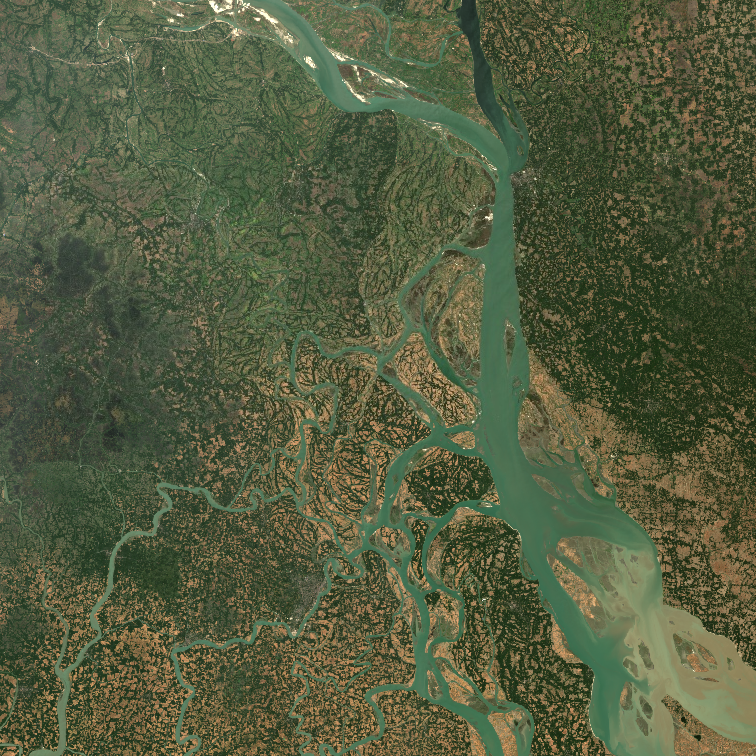
Through the lens of Sustainable Development Goal (SDG) 6 and specific use case studies, the WorldWater project will demonstrate how global coverage EO data, can be used to systematically and accurately measure inland surface water resources. WorldWater will complement existing EO initiatives and projects (e.g. Global Surface Water Explore and the Copernicus global land services) by further developing EO tools and products to effectively use the most up to date, open and free satellite data, primarily from the Sentinel missions, for improved monitoring of the world’s inland water resources in both extent and volume.

WorldWater is, therefore, a crucial project aiming to address the critical needs of authorities, at all levels, to adapt and formulate water policies, and report on water resources, in a timely manner and based on valid scientific information. More specifically, WorldWater will provide essential tools and information to strengthen evidence-based planning and management to support authorities in addressing the global ‘water crisis’.

Satellites are playing an important role in efficient management of water resources

Satellites are playing an important role in efficient management of water resources

17 April 2020

Building on the Sen-ET project led by DHI-GRAS, the European Space Agency (ESA) just published this news story featuring our state-of-the-art technology for deriving accurate measurements of evapotranspiration at parcel level. Our technology enables detection of water stress and irrigation support, at individual field scale, anywhere in the world. Currently, we are supporting irrigation management and precision agriculture activities in five continents.

Background

The Sentinel-2 and Sentinel-3 satellite constellations have highly suitable spatial, temporal and spectral characteristics for many agricultural applications. This includes estimating water evaporation from the soil and transpiration from the leaves (together called evapotranspiration – ET), the knowledge of which is critical for agricultural water resources management and water use optimization.

In order to robustly model ET, both optical and thermal satellite data are needed. The former data is acquired daily by Sentinel-3 at 300 m resolution and by Sentinel-2 every 3 to 5 days at 10 – 20 m resolution. Thermal data is acquired only by Sentinel-3 at around 1 km resolution. ET estimates derived directly from this thermal data would also have a resolution of “just” 1 km, which would obscure many agricultural landscape features.

This is why DHI GRAS together with IRTA and SANDHOLT worked on developing a method to fuse Sentinel-2 and Sentinel-3 data, with the aim of obtaining ET maps with a resolution of 20 m. This was the primary objective of the Sen-ET project.


Frontline technology for water resource management and irrigation support
One application where the Sentinel-based high-resolution actual evapotranspiration (ETa) estimates could be particularly useful is water rights monitoring and water accounting and auditing. Those tasks are sometimes performed at an irrigation district level, but often water use monitoring needs to be undertaken at an agricultural parcel level.

In those cases, the use of high-resolution data is essential. By relying on estimates of ETa, as opposed to potential or reference ET, it is possible to measure water consumption values in a more direct and robust manner. This is because ETa considers the actual water transfer from soil and vegetation into the atmosphere, while potential or reference ET are theoretical maximum values reflecting, respectively, water use of unstressed vegetation or atmospheric demand.

In the video at the bottom of the page we can observe the extra spatial detail which is revealed when using the Sen-ET methodology. At the native resolution of the Sentinel-3 thermal observations’, it is not possible to distinguish any agricultural fields or other landscape features, while at Sentinel-2 spatial resolution all the parcels are clearly visible. Focusing on the pivot irrigation fields in the top-left corner, with fine spatial resolution, we can easily separate both the total ETa of the different fields and the unique temporal pattern of each field (see figure below).

Those estimates can then be compared with either total rainfall values or with ETa of an un-irrigated area, close by, to calculate irrigation water input at parcel level. At coarse spatial resolution, the ETa estimate contains aggregated values from the adjacent fields as well as non-irrigated land in the vicinity of the fields, making such comparison more difficult.

The accuracy of the modeled ETa has been validated extensively in the Sen-ET project. The results indicate an uncertainty of around 30% in herbaceous agricultural fields, such as the irrigation pivot parcels. This number is a result of comparing instantaneous ETa estimates against 30-minutes eddy-covariance flux tower observations. The uncertainty in the flux-tower observations is usually in the order of 20% and this reflects on the satellite-based estimates’ accuracy. In addition, when aggregating the instantaneous estimates to daily, seasonal or yearly values the accuracy increases significantly as it cancels out random errors.

Application potential and way forward
Water is essential for life on Earth. Water is a critical natural resource that underpins all social and economic activities. Tools that can underpin further optimisation of water resource use and minimise consumption are instrumental in order to secure sustainable water resource management worldwide. Our cutting-edge methodology to derive reliable and timely ET estimations at field level provides a vital instrument to support informed decision making of critical water resources.

Our method provides critical information to support water use efficiency within several domains, including irrigation management, by providing an indicating of areas where crops experience water stress, as well as water licensing schemes by providing a cost-effective and efficient means to do water accounting.

The development of our state-of-the-art ET tool builds on several years of research led by Dr. Radoslaw Guzinski. Rado (PhD from the University of Copenhagen with a thesis focusing on remote sensing of evapotranspiration) is a Senior Remote Sensing Specialist and Software Engineer with DHI GRAS and was previously a Research Fellow with the European Space Agency (ESA). While at ESA he significantly contributed to the Mission Requirements Document for the proposed Copernicus High Spatio-Temporal Resolution Land Surface Temperature Mission.

For more information about our ET approach and ongoing work, please contact Rado at rmgu@dhigroup.com.

If you would like to know more about how our tool can be put into practice in your company, please reach out to our Business Development Manager, Torsten Bondo at tbon@dhigroup.com