VeriCAP

Why is it important?

Every year, paying agencies across the EU performs thousands of on-site control visits to field parcels across nations, to check if farmers report correctly on crop types and farm management practices according to the rules, procedures and eligibility requirements under the framework of EU’s Common Agricultural Policy (CAP). A single control visit is often not sufficient to cover the different agricultural activities over the year, thus increasing demands of time and resources for both paying agencies and applicants.

How can it help?

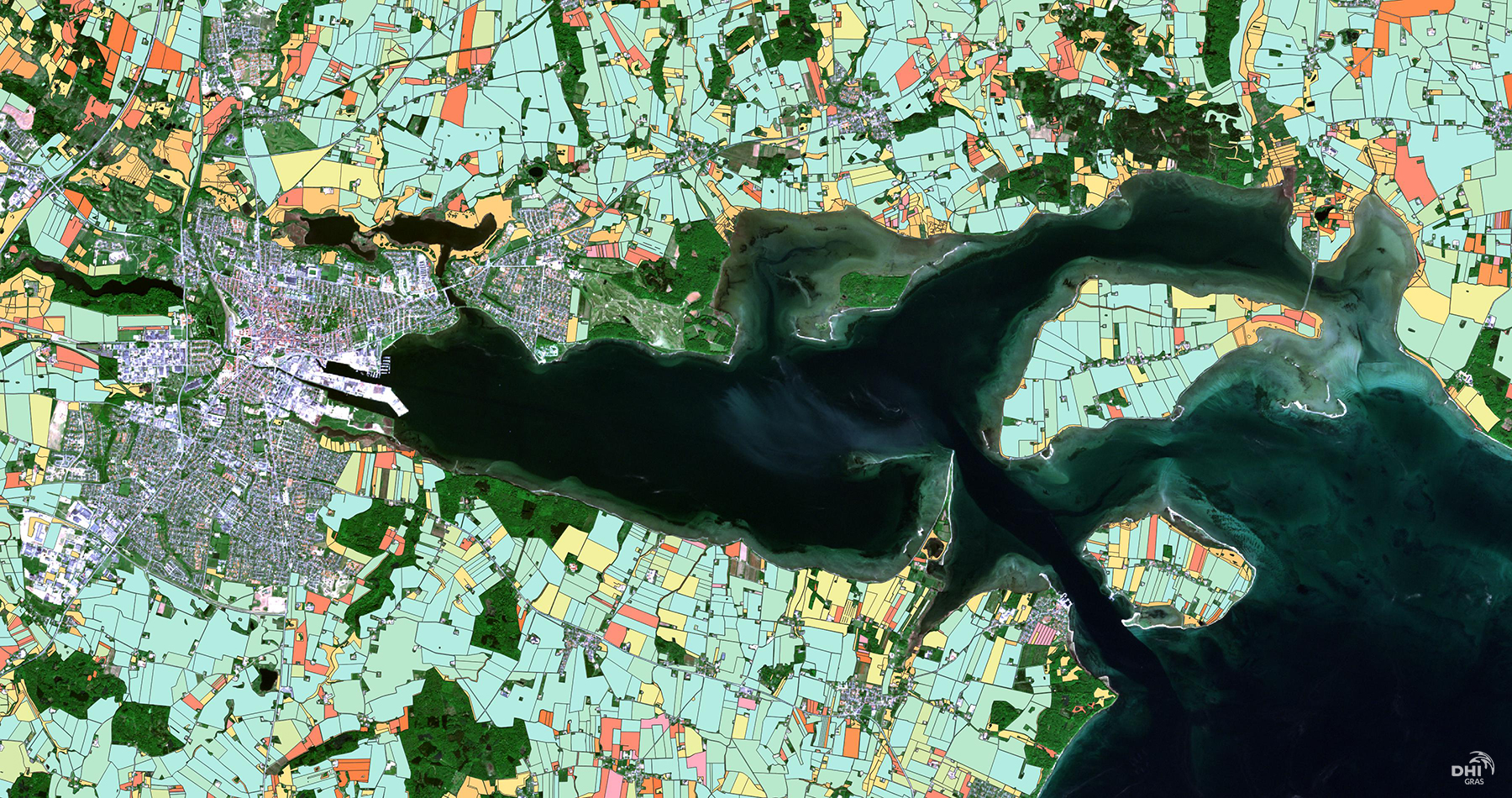
In line with the requirements of the 2020 CAP reform, aiming to modernize and simplify CAP requirements, satellite-based CAP monitoring solutions are increasingly being adopted to address the existing monitoring burden, as a cost efficient and effective solution to monitor crops and activities on field parcels at national level.

VeriCAP provides a streamlined and accurate check by monitoring (CbM) solution to monitor crop types and farm management practices according to CAP rules and requirements. VeriCAP has been developed, tested and operationally implemented at national level by the Danish Agricultural Agency (DAA), as an end-to-end CAP monitoring solution, enabling them to harmonise existing monitoring frameworks, reduce the need for field visits and ultimately, increase effectiveness and reduce costs.

VeriCAP provides an integrated, scaleable and flexible solution that serves the specific priorities and local conditions of each EU member state or regional authority.

What you get!

A powerful back-end image processing chain for handling petabytes of satellite data to validate parcel boundaries,  map and monitor crop types, grassland activity, harvest and ploughing and catch crops.

An advanced analytics toolbox for machine learning, deep learning and time series analysis and a sleek front-end web viewer for easy presentation of results and reporting.

A tailored and integrated solution conforming to local conditions and specific needs and requirements of the client. 

Typical customers?

National and regional paying agencies in the EU with a need to increase effectiveness in CAP monitoring in line with the requirements of the CAP2020 reform

Specifications

  • Six core CAP monitoring services:
      1. Parcel boundary validation
      2. Crop classification
      3. Grassland activity
      4. Ploughing
      5. Harvest
      6. Catch crops
  • Parcel level analysis as well as subparcel /pixelbased analysis and products – making best use of Sentinel 1/2, Landsat and commercial data sources, such as Planet data.

  • Markers updated on a daily basis and solution is operational on national scale
  • A sleek and customized interactive web viewer for easy data visualization, interpretation and reporting
  • The solution is available for any country or regional authority in the EU and flexible to be implemented based on the specific needs,  regulations, and regional conditions 

More information

Contact Lotte Nyborg (ln@dhigroup.com) for more information on VeriCAP.

EOatDHI part of the DHI GROUP

gras@dhigroup.com
+45 4516 9100

Agern Alle 5,
2970 Hørsholm,
Denmark

CVR: 36466871

Crop Mapping Inventory

Why is it important?

Crop mapping inventory is needed for government and national purposes but is also equally important for agri-businesses, farmers and as an input to support subsidies and certification systems.

Valuable information on crop status and growth development can be provided throughout the growing season to monitor crop progress and identify any signs of damage or stress.

How does it work?

Crop mapping refers to the inventory assessments of what is grown on the fields as well as the operational assessment of crop growth during a growing season.

What you get!

Up to date crop area and statistics of the major crop types

In-season operational assessment of crop health and status

Valuable information on crop type and acreage statistics can be provided on annual and semi-annual basis

Typical customers?

Agronomist can use crop inventory as input to models for the further assessment of harvest and yield prediction, soil productivity, or land use intensity

Agencies use crop inventories to monitor and plan growing seasons and for EU regulations on subsidies for crops

Agricultural companies such as fertilizer companies and seed producers can use crop information to better manage supply chains and improve sales

Specifications

Crop classification is benefitting from the recent surge in SAR and optical data availability, coupled with the development of advanced machine-learning classification algorithms.

SAR data provides information relating to structural characteristics of crops, including size, density, orientation and surface roughness, while optical imagery provides data related to leaf pigmentation, cell structure and moisture content.

We use a data fusion approach to crop classification as it offers the highest potential for accurate mapping. We have provided crop type mapping with average accuracies up to 95%.

The main output attribute of the classification will be the predicted crop class for each field parcel in the control zone. As an additional source of information that can help to evaluate class confidence, we will include crop class probability values.

Price list

The production of custom tailored crop inventory is between 1.5 and 2.5 Euro/km2.

For operational crop monitoring please contact us.

EOatDHI part of the DHI GROUP

gras@dhigroup.com
+45 4516 9100

Agern Alle 5,
2970 Hørsholm,
Denmark

CVR: 36466871

Monitoring agricultural fields with satellite images

Satellite data analysis remote sensing earth observation Monitoring agricultural fields

How we helped:

Machine Learning and Data Fusion for crop-type monitoring. By building a likelihood model based on timing of the main crop harvest, the timing of parcel tillage after the main harvest and the field greenness in the September period to monitor the presence of catch crops.

Project highlights:

Building a national operating system for deriving agricultural parameters based on time series of both SAR and optical satellite data

Development of a user friendly web viewer for visualizing data and results allowing the user to search for specific field parcels and associated attribute information

Analysing time series based on advanced Machine Learning methods and data fusion for crop monitoring and likelihood model for monitoring of harvest and catch crops

In more detail..

The Danish Agricultural Agency is today performing control visits to field parcels across the entire country, to check if farmers report correctly on their crop types and farm management practices related to the CAP.

This line of work constitutes a significant work load and involves many field visits. The Danish Agricultural Agency needed a solution to check if farmers were reporting correctly in accordance with CAP requirements while at the same time reducing the amount of time spent on control visits.

All satellite data and results were presented on a web viewer developed to meet the client’s needs for assessing the satellite-derived information to be used in their CAP monitoring.

In short, we provided the Danish Agricultural Agency with:

Danish Agricultural Agency:

The staff of the Danish Agricultural Agency, a total of approximately 1,200, strives countrywide to create the optimal conditions for sustainable growth and green transformation in the fields of Agriculture and Plants and horticulture.

They administer and provide grants for agricultural production, environmental and ecosystem improvements, development programmes, grants for minor projects, and administer subsidies for certain types of export.

EOatDHI part of the DHI GROUP

gras@dhigroup.com
+45 4516 9100

Agern Alle 5,
2970 Hørsholm,
Denmark

CVR: 36466871