In our previous post, we showed you how satellite imagery from Sentinel-2 captured the fire at Randbøl Hede near Billund on May the 25th.
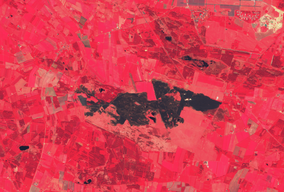
Sentinel-2 as false colour composite (vegetation becomes red) is here seen illustrating the damage of the fire, estimated at around 350 hectares of land.
The video shows the area before, during and after the fire.
In our day to day work with satellite imagery, we often see wildfires e.g. bushfires in Africa and forest fires in Asia, and now also in Denmark.
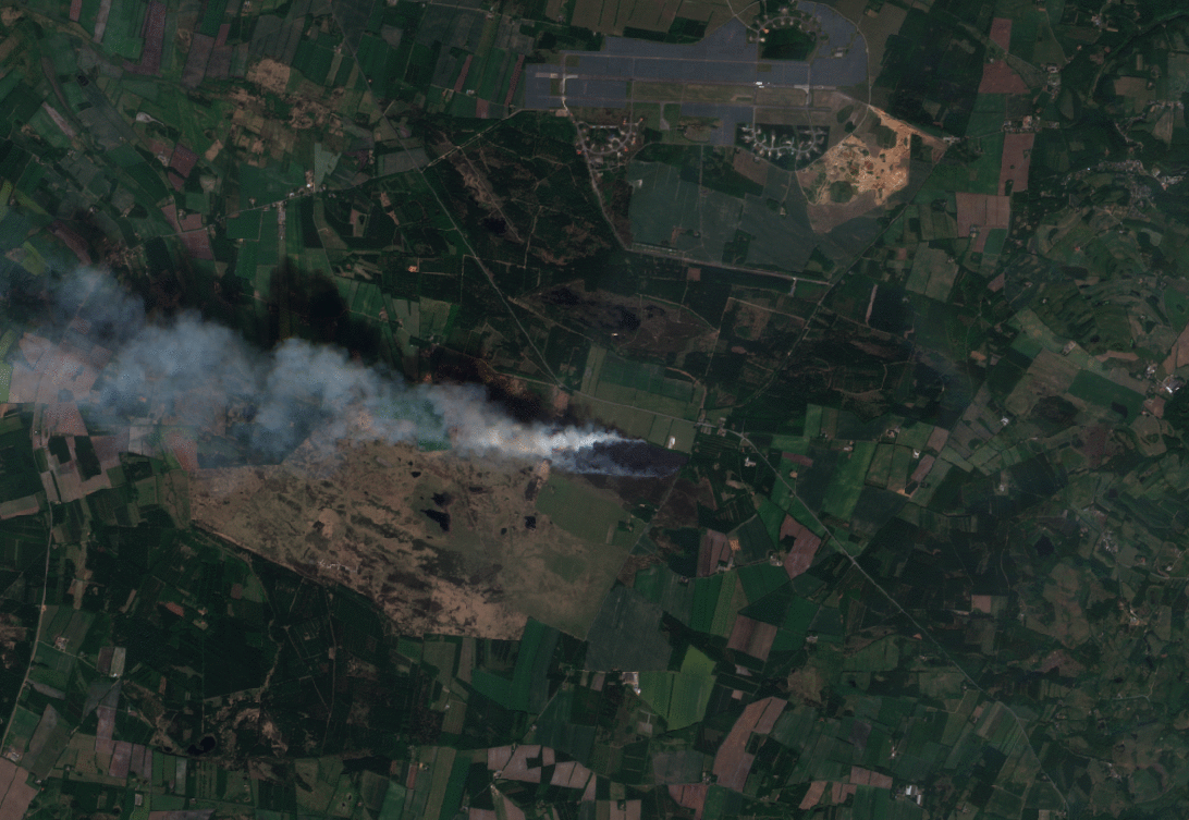
This image acquired by Sentinel-2 captured the fire on Randbøl Hede near Billund on the 7th of May 2018. The first image is a true color showing the smoke from the fire, and the second image shows the location of the flames using the SWIR information from Sentinel-2.
Today is World Water Day. Watch this video (sound on!) to learn how Earth Observation can support water managers and authorities in managing our water sustainably worldwide.
Is your future water use for irrigation a cause for concern?
13 December 2017
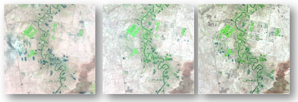
In many parts of the world, water resources are under pressure due to the ever-increasing demand from growing populations and the need for increased agricultural production. Water scarcity is expected to increase in the future, in particular for the 40% of the world classified as semi-arid.
Access to water is therefore recognised as one of the main economic drivers in the semi-arid areas and the United Nations has included water use efficiency as one of the Sustainable Development Goals (SGDs) indicators. However, seen from a policy and investment perspective, there are significant knowledge gaps and uncertainties in how much water is available, used and extracted from these regions. Better data on water use is called for to improve agricultural planning.