SATELLITE-BASED SOLUTIONS TO SUPPORT THE OFFSHORE WIND INDUSTRY:
20 december 2019
Offshore wind has experienced tremendous growth in recent years as an attractive and clean energy alternative. However rigorous environmental legislation and a harsh and dynamic environment require thorough and meticulous planning as well as continuous operational monitoring of windmill installations and the dynamics of the surrounding water bodies.
The majority of the data and information needed to plan, construct and operate offshore wind farms is costly, time consuming and risky to collect, requiring rigorous field campaigns and expensive equipment.
Cost-effective and reliable solutions from space
Satellite-derived data products and services provide a powerful, low cost and efficient alternative to supplement or replace traditional monitoring solutions, by delivering up to date insight on the dynamics of the seabed and conditions of the environment around offshore wind farms. Our key offerings include satellite-based approaches to map and monitor shallow water bathymetry; aquatic vegetation; geomorphological dynamics and sedimentary variations around offshore wind installations. We also provide critical input data components to support offshore wind cable landfall assessments, such as coastal dynamics, digital terrain models and imagery for site planning.
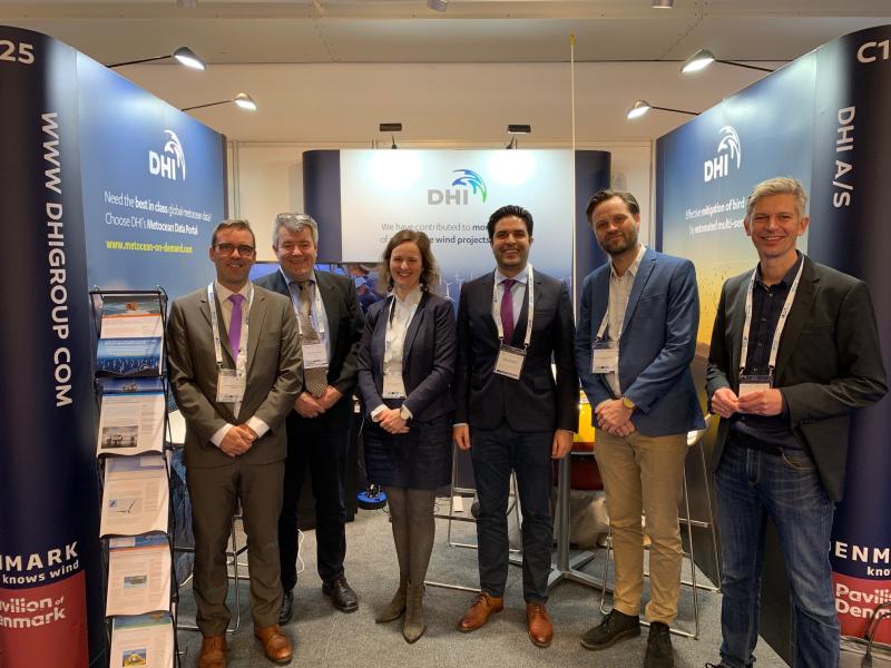
Rasmus Borgstrøm (second from the right) and Torston Bondo (Far right) at WindEurope 2019
Growing interest in satellite-based products among major stakeholders
We have experienced an increased uptake and interest in our products and services, by stakeholders involved in the offshore wind industry, which was most recently solidified at the WindEurope Offshore conference in Copenhagen last month. The conference is a leading platform for peer to peer discussions with industry leaders and specialists and a unique opportunity to grasp the latest industry trends. We were represented by our Managing Director, Rasmus Borgstrøm and Business Development Manager, Torsten Bondo and their discussions with peers, potential clients and collaborators indicates a significant continued interest in our Earth Observation products, designed to support the monitoring needs of offshore wind operators.
Continued engagement with offshore industry partners and clients in 2020
As we are approaching the end of 2019, we are reflecting on an upbeat year where we have been excited to experience this attention and acceptance of our products and services by clients in the offshore wind industry, and we are looking forward to 2020 where we will continue to push our reliable and low-cost tools to support offshore wind farm operations.
See the video to below for further information and insight on how our products match the needs of clients and stakeholders in the offshore wind industry.
Satellite based solutions to map and monitor the distribution of underwater vegetation dynamics in shallow water areas provides a cost-effective and efficient tool for consistent synoptic monitoring of large areas.
Delivering key insight on vegetation status and trends, satellite data provides a critical tool, enabling management authorities and decision-makers in making more effective decisions towards protecting and managing marine environments and resources.
Using high-resolution satellite data, novel machine learning techniques and advanced data processing, we have created the first-ever national overview of the spatial distribution of shallow-water submerged aquatic vegetation in Denmark.
The national map of submerged aquatic vegetation provides an important baseline on the current status of vegetation density in Danish territorial waters. Future efforts will aim to advance the baseline by making continuous assessments on year to year and intra annual variations in vegetation cover at national level.
With an established methodology and a scalable approach in place, satellite data can now be turned in to actionable data and information about the condition and status of submerged aquatic vegetation in shallow water areas, in any part of the world.
Thanks to the VELUX FOUNDATION for their generous grant, which has allowed us to reach this significant milestone.
Visit http://satlas.dk/marine-vegetation/ or click the button below to see the vegetation density map and learn more about satellite-derived aquatic vegetation mapping.