Supporting the Copernicus Land Team at the European Environmental Agency:
28 June 2019
In continuation of our excellent collaboration on previous activities with the European Environment Agency (EEA), DHI GRAS is providing on-site consultancy services for the Copernicus Land Team at the centrally-located offices of the EEA in the heart of Copenhagen.
We are supporting the Copernicus Land Team with on-going Pan-European mapping activities and advising on technical specifications including recommendations on geospatial data and systems integration, such as the integration of Copernicus Land Monitoring Service (CLMS) data in DIAS (Data and Information Access Services) platforms.
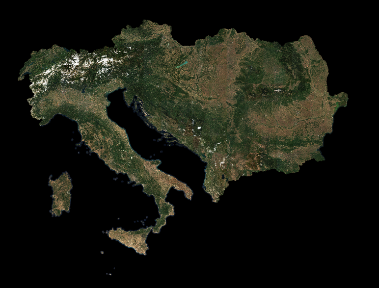
We are also producing seamless high resolution image mosaics of 39 European countries (EEA39), which are both geometrically and radiometrically corrected.
Copernicus is the European Union's Earth Observation Programme, looking at our planet to provide users in the field of environment and other terrestrial applications with information based on space data in six thematic areas: land, marine, atmosphere, climate change, emergency management and security.
For more information about our previous activities with the EEA and Copernicus Land Monitoring Service
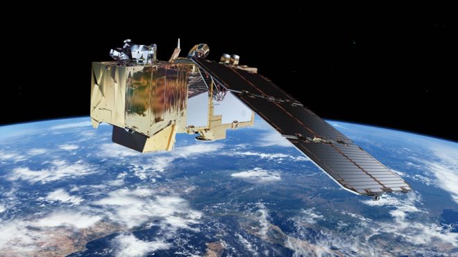
A new system is being considered for inclusion in the EU’s Earth Observation programme, Copernicus, to estimate water-use by plants evapotranspiration and to improve crop water-use productivity.
The Land Surface Temperature Monitoring (LSTM) mission will be able to identify the temperatures of individual fields and would be more than 400 times as detailed as what is delivered by the current Sentinel satellite land surface temperature sensors.
The increased resolution and precision of LSTM will enable specialists to calculate in real time how much water different plants require in different areas, and how often those plants need to be irrigated. It could also be used to help predict drought conditions.
The LSTM mission will complement the existing family of Copernicus satellites, sentinels, for observing the land and coastal areas, and will hopefully become an operational spacecraft within the next decade.
Our senior remote sensing specialist, Radoslaw Guzinski, is one of the authors behind the Mission Requirements Document, and we will follow the activities closely in the coming years.
In the meantime, we are working on innovative methods and tools to estimate field-scale plant water-use with the data coming from existing Copernicus satellites.
See link below for project website.
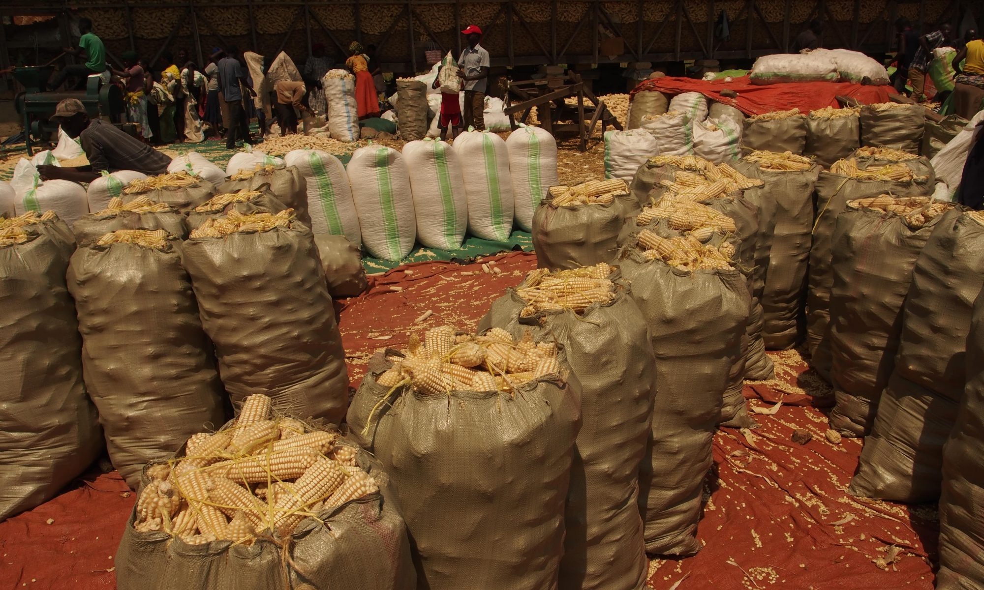
As part of our AI4Earth grant funded by Microsoft and National Geographic Society, Torsten Bondo is in Washington DC for the annual National Geographic Explorer Festival.
It is an extremely exciting and inspiring venue featuring marine biologists, glaciologists, mountaineers, photographers and many other people with an interest in natural sciences.
Torsten Bondo is there to discuss our Uganda project using AI and satellites to assist agricultural irrigation schemes and safeguard the scarce water resources. A method that has the potential to work on a global scale.
Berlingske Media has published an article about the project [in Danish].
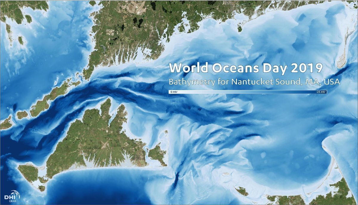
Bathymetry is a key element in Hydrodynamic Modelling and Marine Spatial Planning activities.
Accurate and detailed bathymetry data is therefore an important factor for a successful implementation of a sustainable Blue Economy.
We celebrate World Oceans Day with an example of a bathymetry map from an area with intense focus on Offshore Wind Energy.
Here the Satellite-Derived Bathymetry has been merged with other existing data sets to create a seamless, fully updated and detailed bathymetry layer.
In recent years, advances in the satellite technology and physical modelling has allowed for vast improvements in the accuracy and availability of Satellite-Derived Bathymetry data.
It is also much more cost-efficient than traditional survey methods and mitigates the environmental impact of onsite surveys.
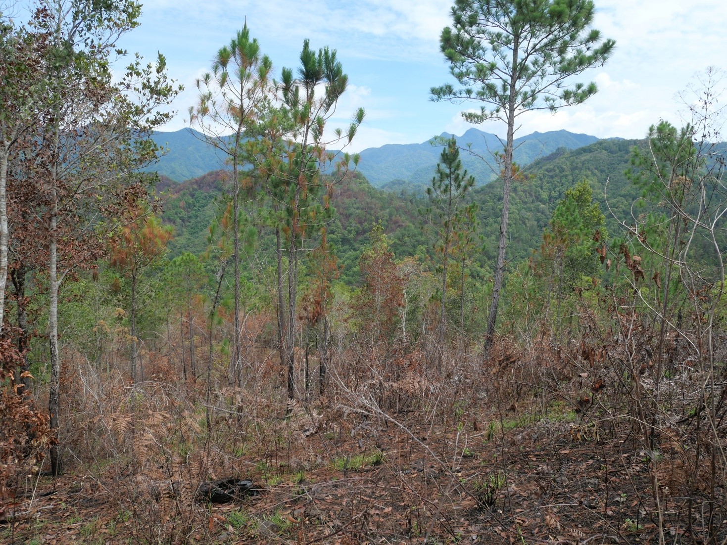
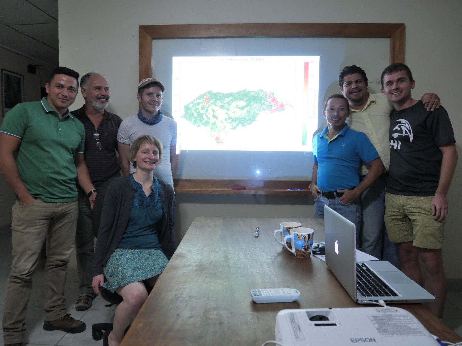
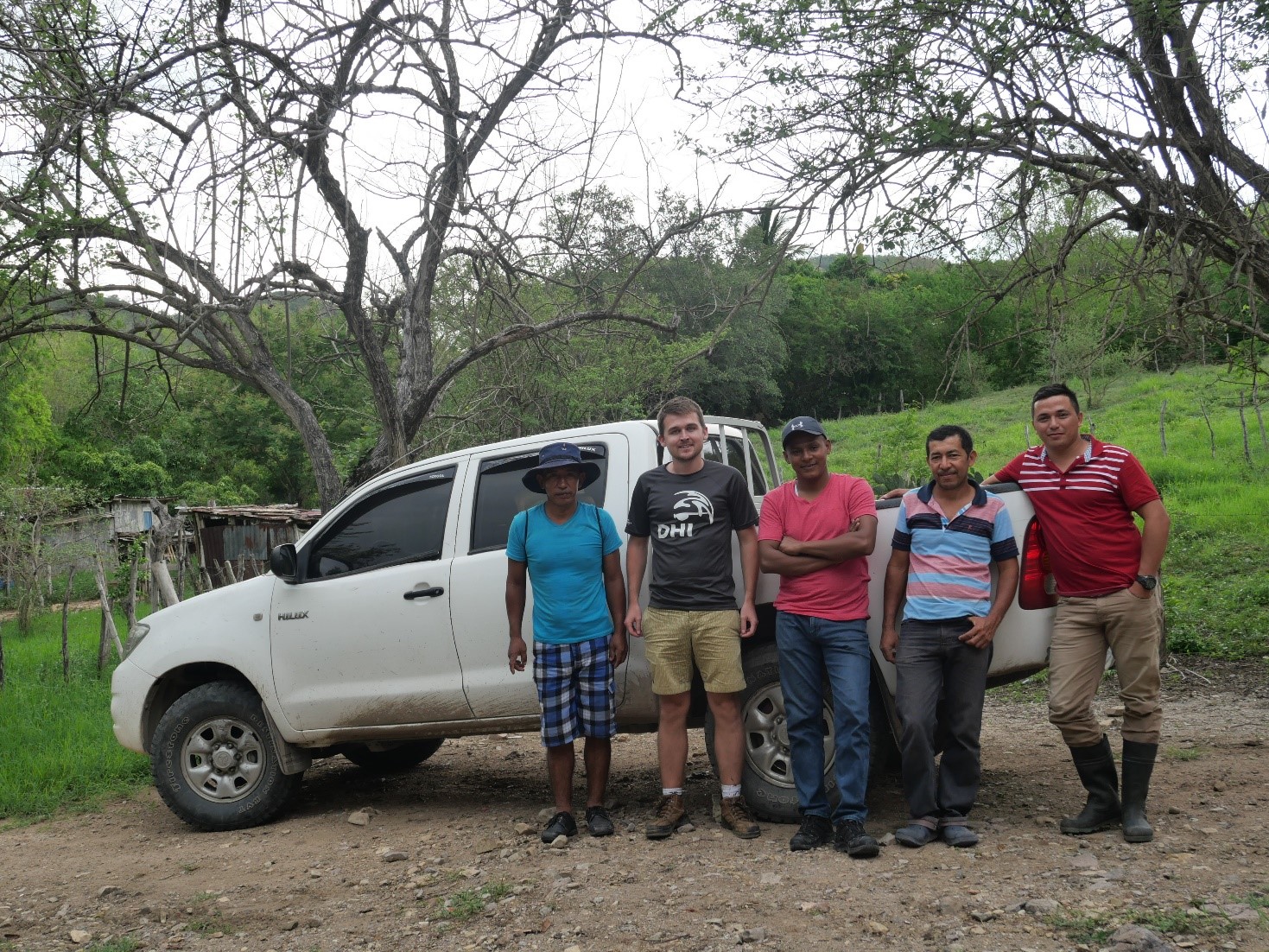
The past two weeks Silvia Huber and Daniel Druce have been in Honduras, where they have held a hands-on training session on using specialized remote sensing tools for forest monitoring with our partner, Forests of the World (Verdens Skove) and assessed the results in the field.
The aim of the training was to teach local key individuals from Forests of the World how to use Google Earth Engine and other tools for monitoring pine forests affected by the destructive pine bark beetle, including the methodology of a fire risk analysis.
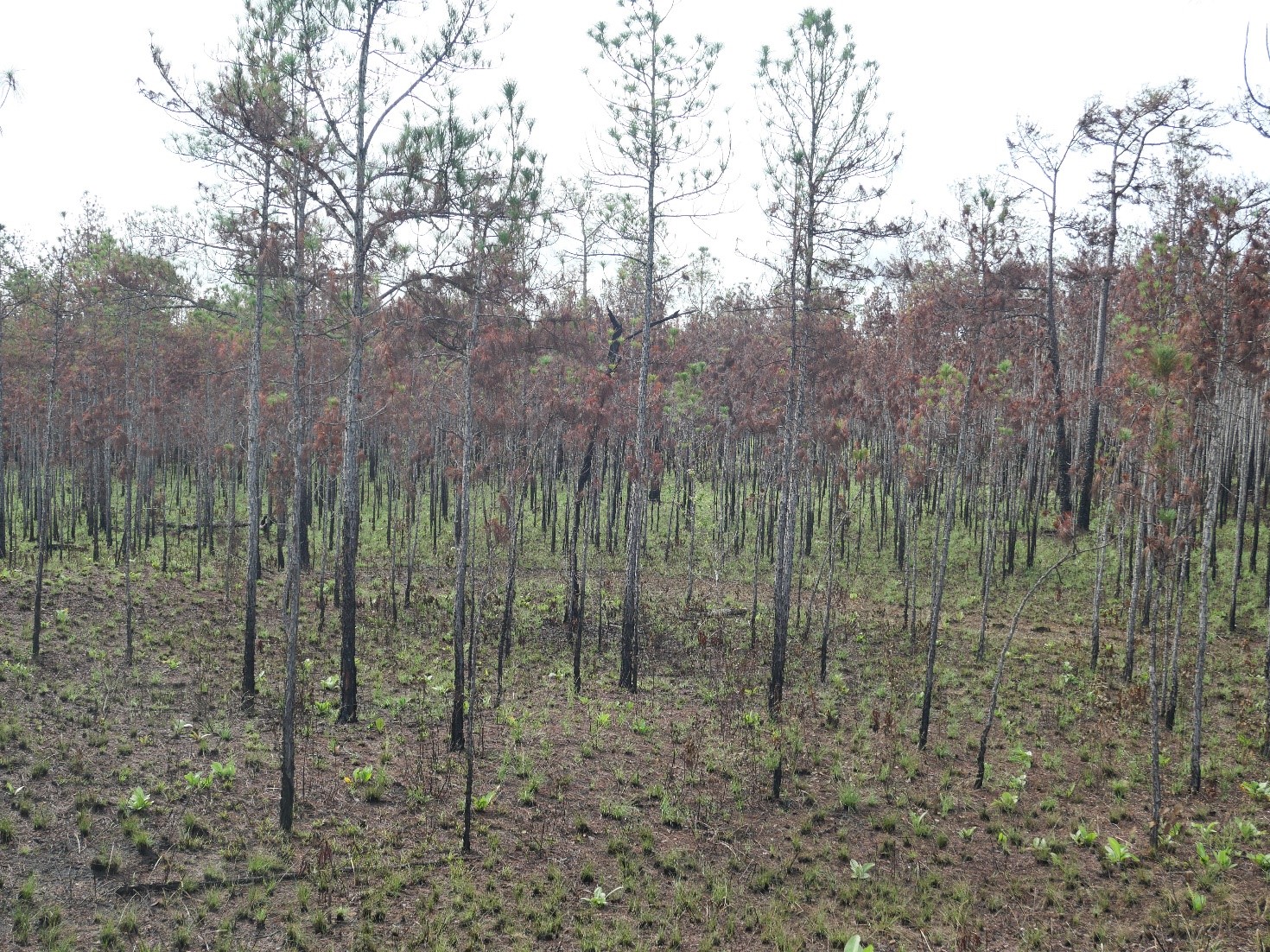
We also evaluated the effectiveness of the results, we have created for pine bark beetle monitoring. Few areas are currently under attack from pine bark beetles, which limits the validation results, but attacks are expected in the near future, which is why it is important to develop monitoring systems now so they are in place when the attacks happen again.
Burnt areas were easily detected, which is good news as both threats cause the pine trees to turn red. Therefore, it is likely, that it will also prove a good indicator of pine bark beetle attacks but further validation is necessary.
Our training was well received, and we look forward to continuing our activities in Honduras with Forests of the World.
Forest of the World has written a blog post about our joint ventures in Honduras [in Danish], follow the link.
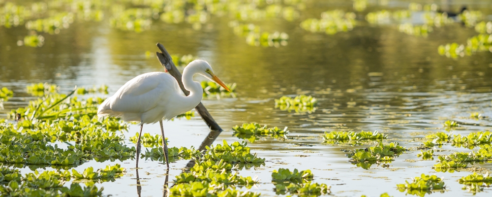
Today is World Environment Day, and we want to highlight the importance of wetlands.
Wetlands are vital ecosystems for countless of species and are among the world’s most productive environments. The properties of wetlands serve as Ecosystem services ranging from freshwater supply to climate change mitigation.
Wetlands are sensitive to atmospheric disturbances, and the ecosystem services that many livelihoods depend on are threatened.
90% of all UN member states have ratified the Ramsar Convention, which provides the framework for the conservation and wise-use of wetlands and their resources.
We are part of a project led by the Ramsar Center for Eastern Africa (RAMCEA), setting out to explore the potential of Earth Observation satellite data for taking stock of and monitoring wetlands.
The project has demonstrated how Earth Observation can support wetland monitoring in Uganda and with continued training sessions can become a valuable tool for wetland managers and practitioners, not only in Uganda, but potentially also paving the way for other East African countries to achieve a complete wetland inventory in the future.
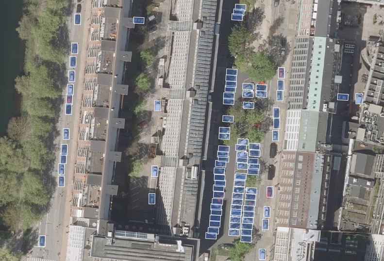
Application of Deep Learning to analyse satellite imagery with improved accuracy . . . . .
Deep Learning
Application of Deep Learning to analyse satellite imagery with improved accuracy
Why is it important?
Information from space is becoming much more accessible with the exponential growth in number of satellites being launched together with advancements in Big Data and Cloud Computing.
This allows for enormous quantities of data to be stored and analysed at a much faster pace and can lead to solving new challenges and optimise traditional ways of monitoring and mapping.
How does it help?
The common approach has been to train classical machine learning algorithms (e.g. Support Vector Machine or Random Forest) to label each pixel in a satellite image.
However, one of the shortcomings of this approach is that each pixel in the image is classified independently of its neighbouring pixels – meaning the spatial context in imagery is not considered.
The main advantage of Deep Learning algorithms is that they can recognize patterns, shapes, and context in imagery, and use this to better map different objects of interest.
By doing so, they use not only the spectral information from pixels, but also the surrounding spatial information that is associated with objects.
This extra information has provided a huge leap forward in computer vision capabilities and is used to more accurately identify specific objects and land cover classes of interest.
What you get!
Significant improvements in classification accuracy using the latest Deep Learning algorithms for image segmentation
Successful object detection and recognition in satellite and aerial images even with limited training data available
Significant improvements in mapping features in open landscapes using Deep Neural Networks
Typical customers?
Maritime industry for detection of reefs, hazardous objects, ships and illegal vessels
Construction industry for detection of roads, built-up areas and general activity in construction zones
Municipalities for detection of traffic patterns, car parks and illegal constructions
Specifications
We develop tailored solutions based on your specific needs.