Application of Deep Learning to analyse satellite imagery with improved accuracy . . . . .

Deep Learning
Application of Deep Learning to analyse satellite imagery with improved accuracy
Why is it important?
Information from space is becoming much more accessible with the exponential growth in number of satellites being launched together with advancements in Big Data and Cloud Computing.
This allows for enormous quantities of data to be stored and analysed at a much faster pace and can lead to solving new challenges and optimise traditional ways of monitoring and mapping.
How does it help?
The common approach has been to train classical machine learning algorithms (e.g. Support Vector Machine or Random Forest) to label each pixel in a satellite image.
However, one of the shortcomings of this approach is that each pixel in the image is classified independently of its neighbouring pixels – meaning the spatial context in imagery is not considered.
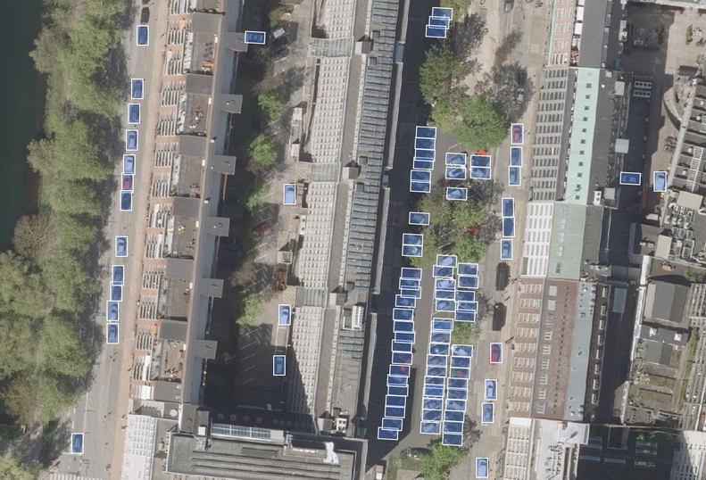
The main advantage of Deep Learning algorithms is that they can recognize patterns, shapes, and context in imagery, and use this to better map different objects of interest.
By doing so, they use not only the spectral information from pixels, but also the surrounding spatial information that is associated with objects.
This extra information has provided a huge leap forward in computer vision capabilities and is used to more accurately identify specific objects and land cover classes of interest.
What you get!
Significant improvements in classification accuracy using the latest Deep Learning algorithms for image segmentation
Successful object detection and recognition in satellite and aerial images even with limited training data available
Significant improvements in mapping features in open landscapes using Deep Neural Networks
Typical customers?
Maritime industry for detection of reefs, hazardous objects, ships and illegal vessels
Construction industry for detection of roads, built-up areas and general activity in construction zones
Municipalities for detection of traffic patterns, car parks and illegal constructions
Specifications
We develop tailored solutions based on your specific needs.
Price list
Contact us for a quote.
EOatDHI part of the DHI GROUP
gras@dhigroup.com
+45 4516 9100
Agern Alle 5,
2970 Hørsholm,
Denmark
CVR: 36466871
